MOAB, UTAH

The Rivers District

Raft the Heart of Canyonlands
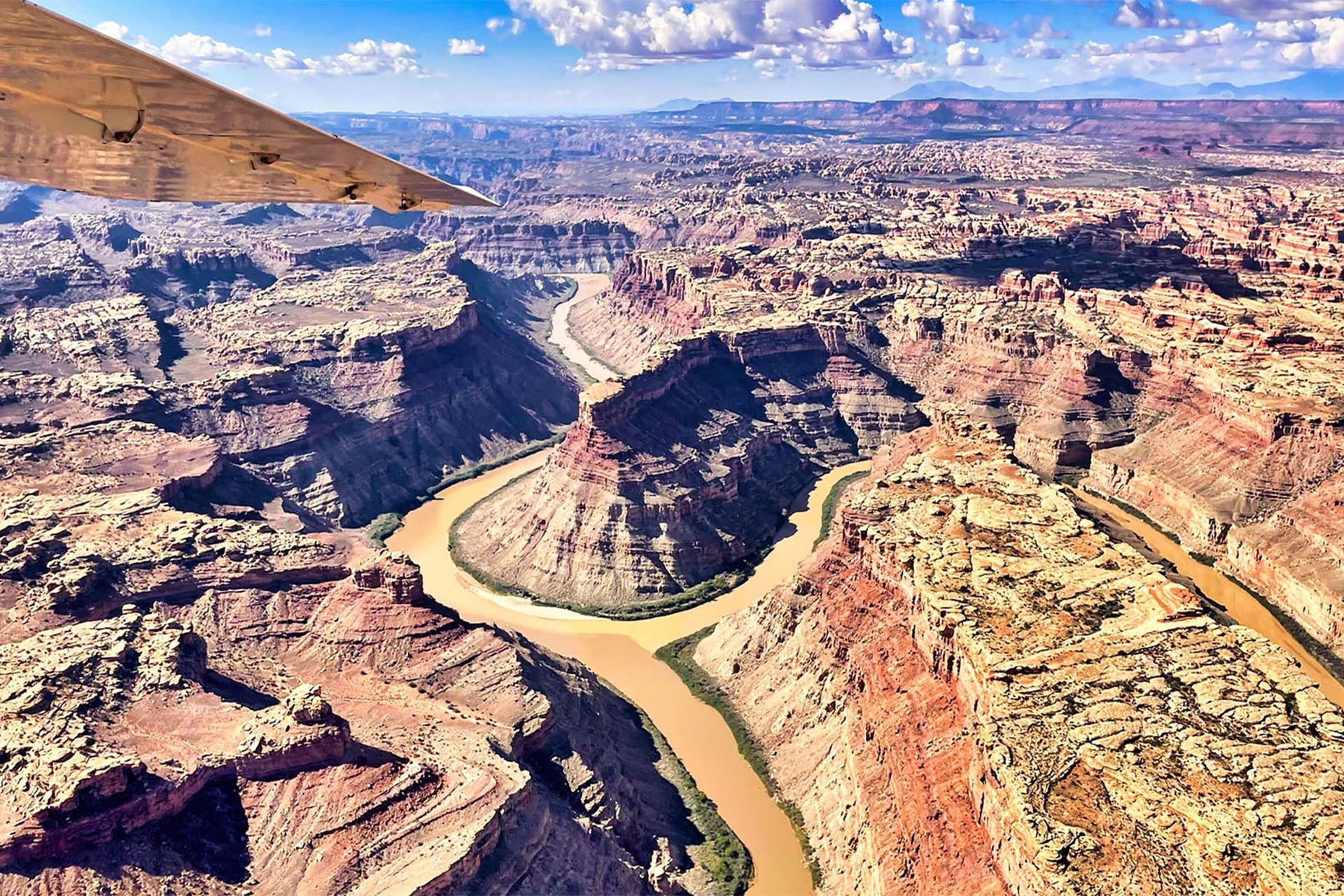
The Colorado and Green Rivers have spent five million years cutting through the canyon country of southeastern Utah. Where they meet inside Canyonlands National Park, the muddy green of the Green River collides with the red-brown Colorado and the two travel side by side, unmixed, for a quarter mile before becoming one. Below that confluence, the water drops 100 feet over 14 miles of whitewater through Cataract Canyon. This is the most dramatic and remote section of the park.
There are no roads into the Rivers district. You arrive by water or by air, which is exactly what makes this district unlike anything else in Canyonlands. Most visitors to the park stand at the rim and look down. MAC’s guests float through the bottom.
This page covers what the Rivers district is, what
Cataract Canyon’s whitewater actually involves, and how to book a trip with Moab Adventure Center.
Canyonlands National Park Quick Links
What is the Rivers District?
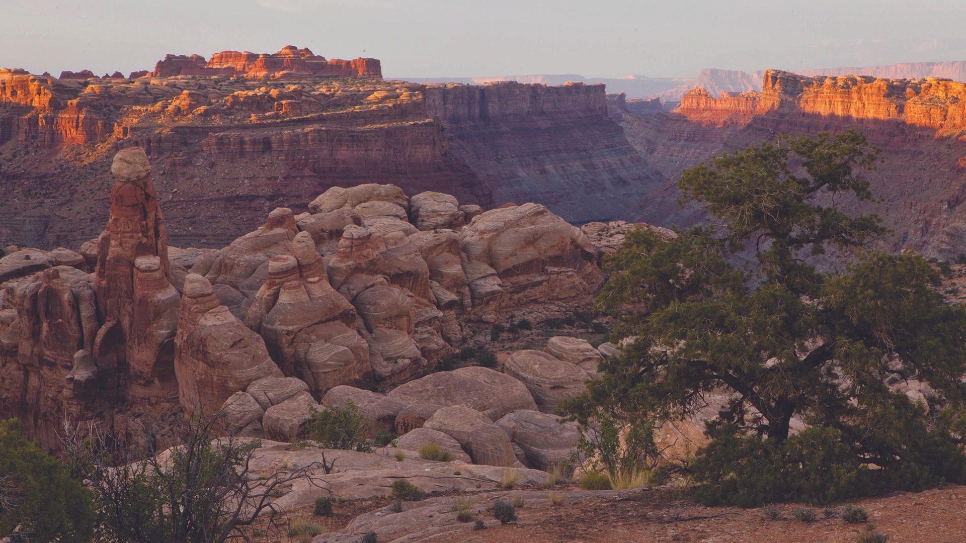
The Rivers district occupies the center of Canyonlands National Park, defined by the corridors of the Colorado and Green Rivers and the canyon system they have carved over millions of years. It extends from the Potash Boat Ramp outside Moab, runs south through Cataract Canyon, and continues to the headwaters of Lake Powell some 100 miles downstream.
This is the most remote district in the park when it comes to access , no trail system, no paved roads, no casual entry point. The canyon walls rise 1,500 feet above the river in places, creating a completely enclosed world with no cell service and no infrastructure. The ecosystem on the canyon floor is distinct from anything visible from the rim overlooks above.
The Rivers district also borders The Maze to the west and The Needles to the east, making it the geographical center of the entire park. From the river, you are looking up at terrain that no other Canyonlands visitor can access without a very different kind of expedition.
Getting There
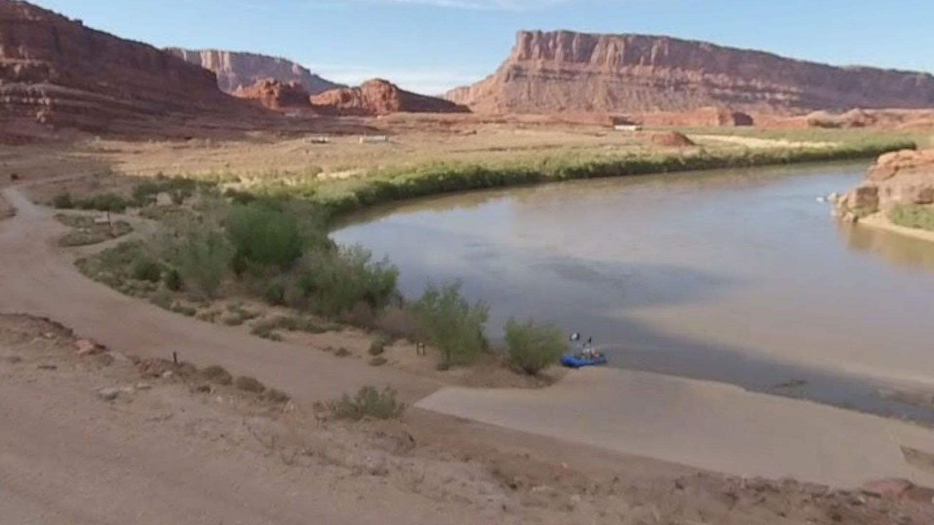
The Rivers district has no road access into the canyon. There are two ways in: by river from the Potash Boat Ramp outside Moab, or by air from Moab’s Canyonlands Field Airport.
If you are booking a MAC river trip, logistics are handled entirely by MAC. You report to the Moab launch point at your designated time. MAC handles the permit, the boats, the gear, the food, and the return. If you are planning an independent river trip, you will need an NPS river permit reserved through recreation.gov well in advance, plus your own equipment and a thorough understanding of the rapid character for the water level you will encounter.
The Potash Boat Ramp is approximately 17 miles from Moab via Utah Scenic Byway 279 (Potash Road). This stretch of road along the Colorado River is itself worth the drive — dinosaur tracks, petroglyphs, and canyon walls run directly alongside the pavement for most of its length.
What You’ll Experience in the Rivers District
The Rivers District is not a hiking destination. You experience it from the water. These are the features and landmarks that define a Cataract Canyon trip.
The Confluence
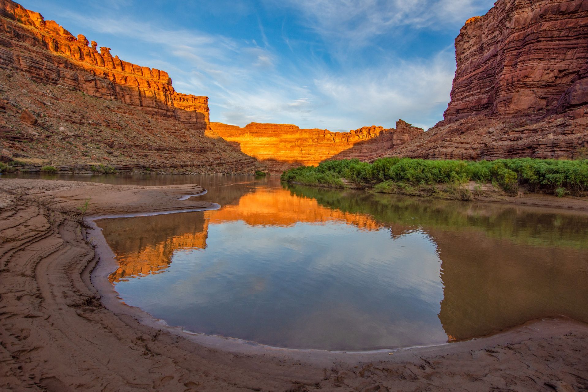
Where the Colorado and Green Rivers meet inside the park. The two currents travel side by side, unmixed, for a quarter mile before blending — identifiable by distinct colors. At river level, the canyon walls close to 300 feet across.
Cataract Canyon
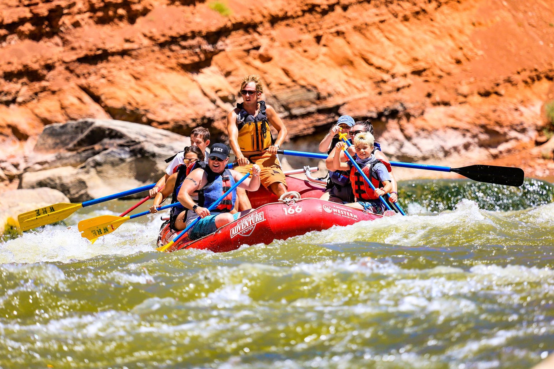
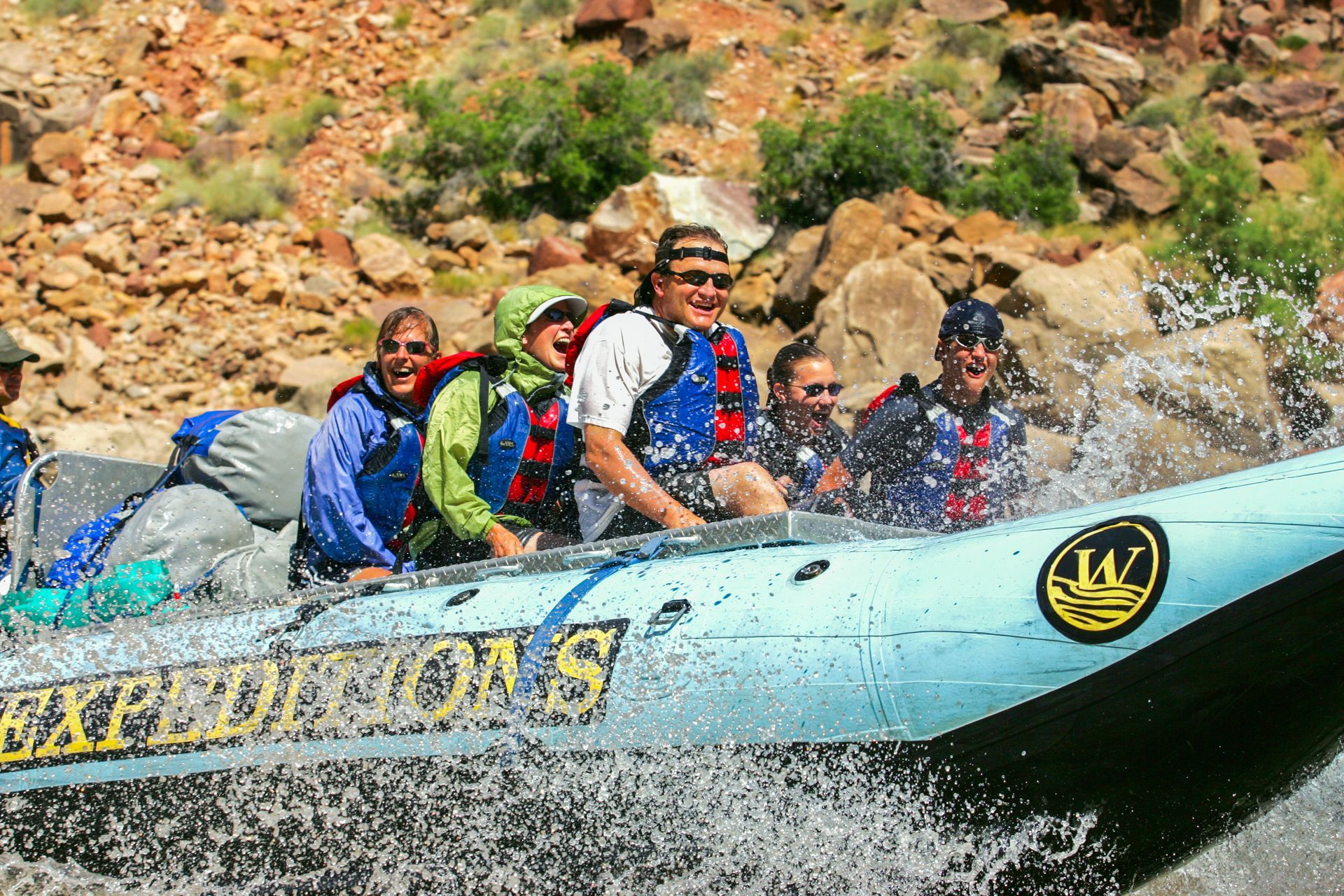
Fourteen miles of Class III to V whitewater beginning 4 miles below the Confluence. Around 26 named rapids. One of the premier commercially run whitewater rivers in North America. The character changes with the season.
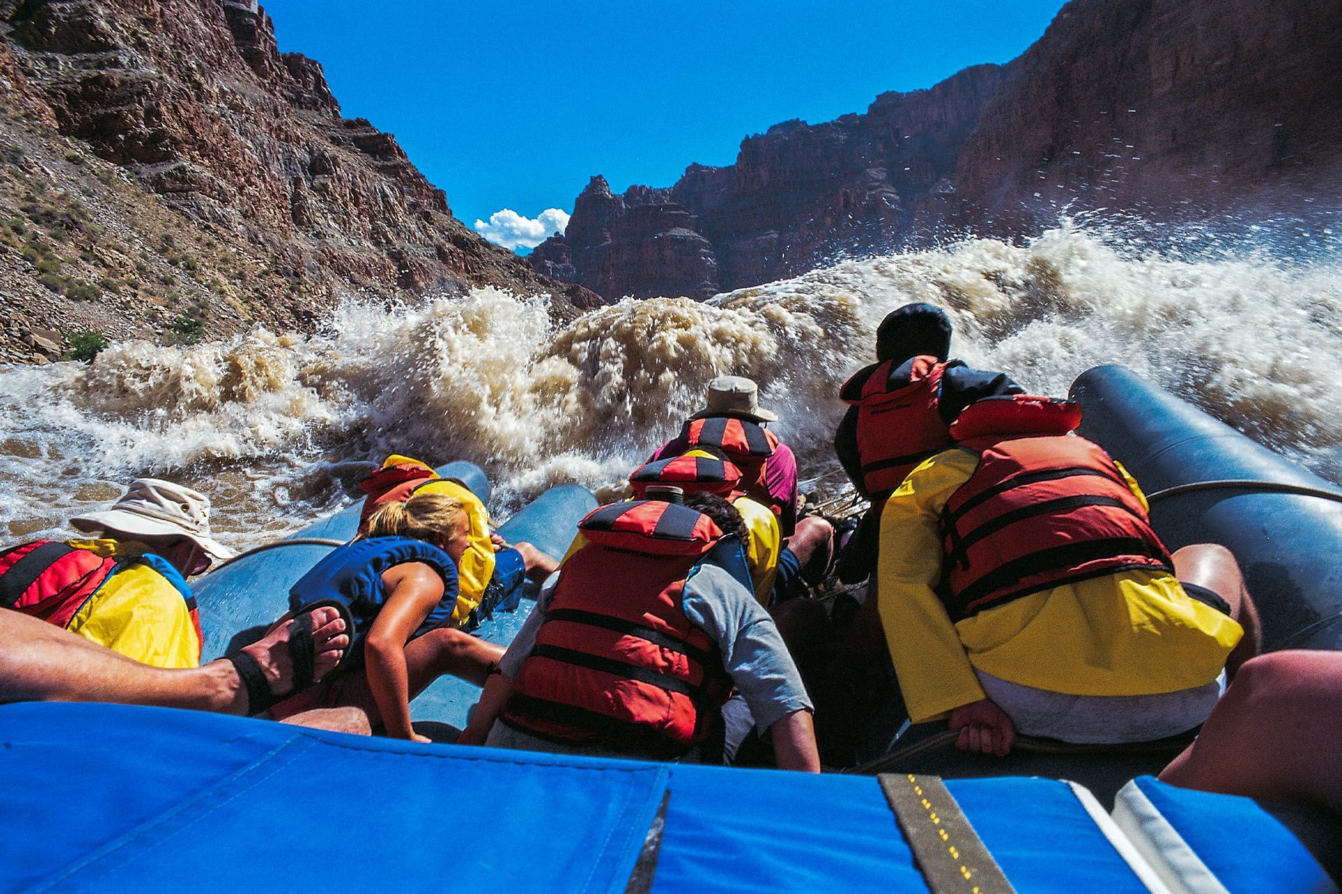
The Big Drops
Three consecutive major rapids at the bottom of Cataract Canyon: Big Drop 1, Big Drop 2, and Big Drop 3, which includes Satan’s Gut. At peak spring runoff, this sequence reaches Class V. The climax of every Cataract Canyon trip.
Potash Road
Where the Colorado and Green Rivers meet inside the park. The two currents travel side by side, unmixed, for a quarter mile before blending — identifiable by distinct colors. At river level, the canyon walls close to 300 feet across.
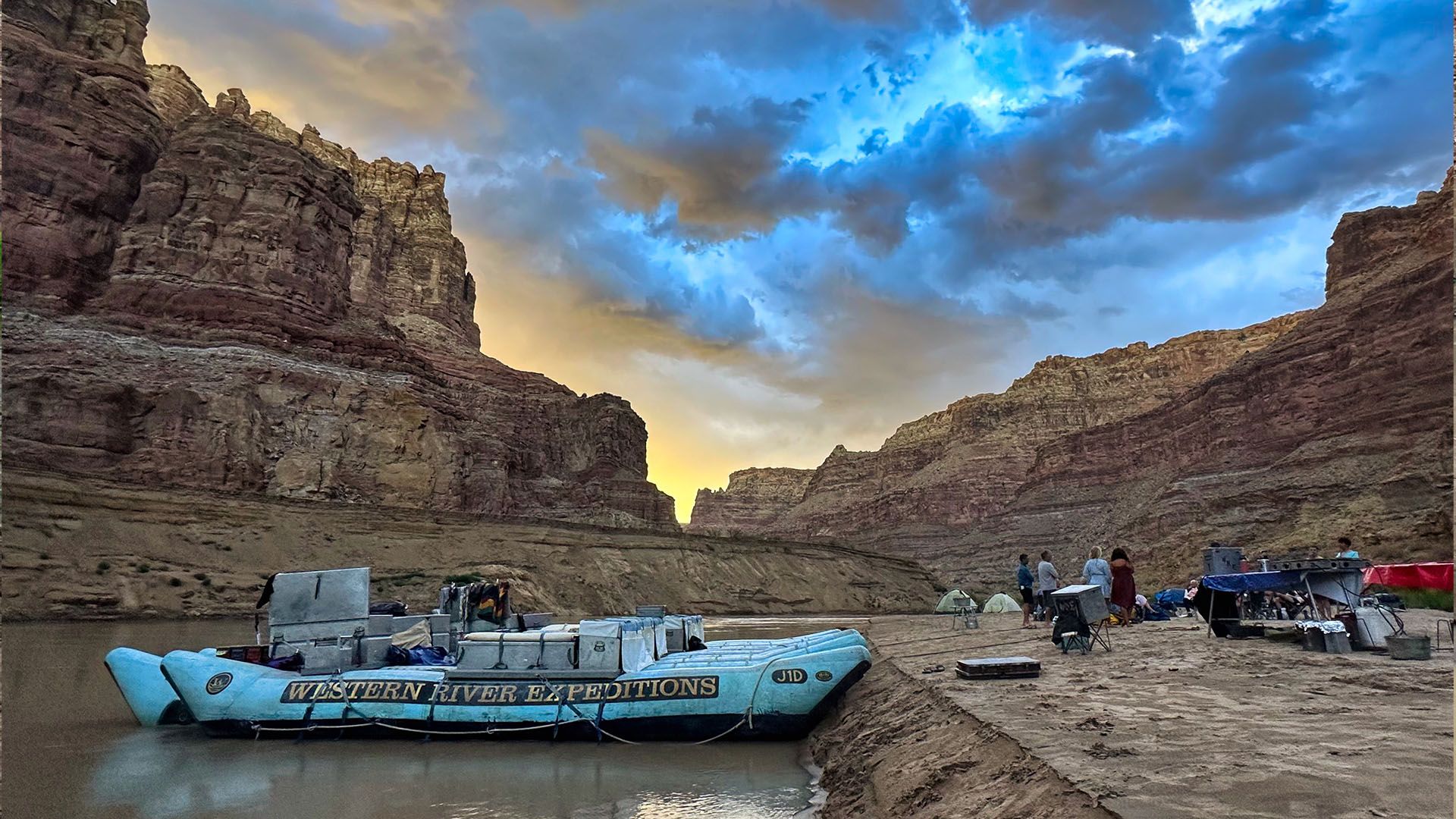
Flatwater Corridor
The 65 river miles between the Potash Boat Ramp and the Confluence run through a deepening canyon with no rapids and no roads. The walls rise progressively as you move south. The 4-day trip covers this section at a pace that lets the scale register.
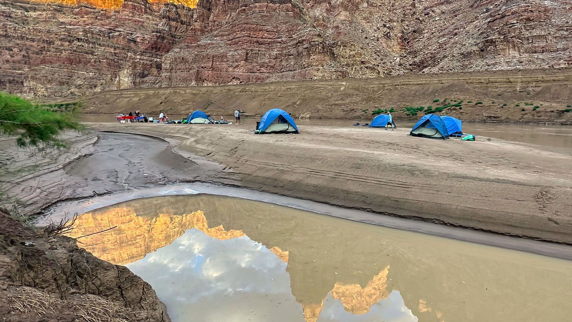
Riverside Camps
Camp sites in the canyon sit at river level with walls rising hundreds of feet on all sides. No roads. No cell service. No sound except the river. The most completely enclosed wilderness experience in Canyonlands.
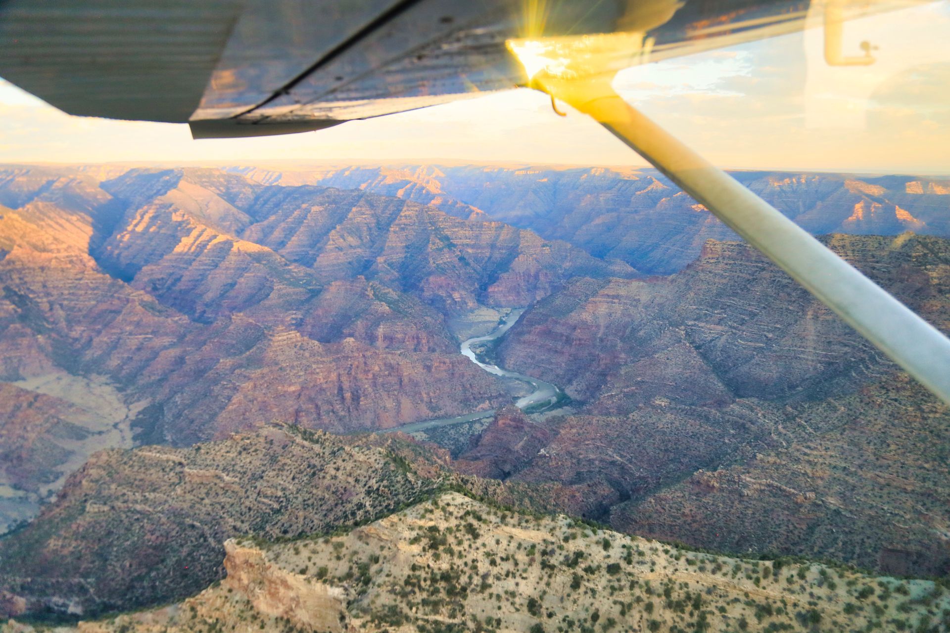
Aerial Approach
The only way to see the full Rivers District without a river trip is from the air. MAC’s scenic flights cover the Confluence, the Cataract Canyon corridor, and all four Canyonlands districts from above.
Best Time to Raft Cataract Canyon
Spring (May to June) Peak runoff from Rocky Mountain snowmelt. Biggest water of the year — Class IV–V conditions in the Big Drops. The most intense Cataract Canyon experience. Temperatures are mild at river level.
Summer (July through August) Water levels drop through July and August. Rapids grade at Class III–IV. Hotter in the canyon but manageable with early starts. More predictable conditions for first-timers.
Fall (September through October) Low water, mellower float, and some of the best weather of the year. Canyon walls in October light are exceptional. A good choice for visitors who want the canyon experience over the biggest whitewater.

Cataract Canyon: The Whitewater
Cataract Canyon runs approximately 14 miles and contains around 26 named rapids. The rapids begin roughly 4 miles below the Confluence and build in size and intensity through the canyon. The biggest water in Cataract — the stretch most people come for — runs through the lower canyon in the final miles above Lake Powell.
The canyon is one of the premier commercially run whitewater rivers in North America. In high water season, the volume and power of the rapids puts it in the same category as the Grand Canyon’s biggest water. In lower water, the technical character changes but the canyon itself does not get less impressive.
The Big Drops
The most significant rapid section is the Big Drops — three consecutive major rapids near the bottom of the canyon that represent the climax of any Cataract trip. Big Drop 1 introduces the sequence with a steep horizon line and a powerful hole at the base. Big Drop 2 is considered the most technically demanding, with a tight line and significant consequences for a miss. Big Drop 3 is the largest by volume and includes Satan’s Gut, a hydraulic that runs the full width of the river at high water.
At peak spring runoff (May through June), the Big Drops can reach Class V. In summer and fall conditions, they grade at Class IV with Class III approach rapids. The canyon’s character is meaningfully different depending on the season.
Frequently Asked Questions About the Rivers District
What is Cataract Canyon?
Cataract Canyon is a 14-mile stretch of whitewater on the Colorado River inside Canyonlands National Park, beginning approximately 4 miles below the Confluence of the Colorado and Green Rivers. It contains around 26 named rapids, including the Big Drops at the lower end of the canyon. At peak spring runoff, the Big Drops reach Class V. It is one of the premier commercially run whitewater rivers in North America.
How difficult is rafting Cataract Canyon?
Difficulty depends on the season. Spring high water (May to June) produces Class IV–V conditions through the Big Drops. Summer and fall water levels drop to Class III–IV. MAC’s trips are guided, fully outfitted, and designed for guests without prior rafting experience. If you can swim and are in reasonable health, the 2-day trip is accessible. The 4-day trip requires more stamina but no technical skills.
How far is Cataract Canyon from Moab?
The Potash Boat Ramp launch point is 17 miles from Moab. From the launch point, the river travels approximately 65 miles to the Confluence before entering Cataract Canyon. On a 2-day MAC trip, motorized support covers significant mileage so guests experience the canyon without the full flat-water float. The 4-day trip covers the full river journey at a slower pace.
Do I need rafting experience for MAC’s Cataract Canyon trips?
No prior rafting experience is required. MAC’s guides handle the technical aspects of navigating the rapids. You should be comfortable around water and able to follow guide instructions quickly in fast-moving situations. If you have specific concerns about physical limitations, contact MAC before booking.
What is included in the Cataract Canyon trip?
MAC provides all boats, paddles, safety equipment, dry bags, camping gear, and all meals on the river. Personal clothing, transportation to the launch point, and gratuity are the guest’s responsibility. The NPS river permit is secured by MAC and included in your trip booking.
What is the best time of year to raft Cataract Canyon?
Spring (May to June) offers the highest water and biggest rapids — the classic Cataract experience. Summer (July to August) is hotter with lower, more technical water and more predictable conditions. Fall (September to October) is the quietest season with excellent weather and a mellower float. Each window delivers a genuinely different version of the canyon.
What is the Rivers District of Canyonlands National Park?
The Rivers District is the canyon corridor formed by the Colorado and Green Rivers in the center of Canyonlands National Park. It is the only district with no road or trail access — entry requires a river permit and a boat, or an aerial approach. The district includes the Confluence where the two rivers meet and Cataract Canyon below it. It borders The Maze to the west and The Needles to the east.
Not finding what you're looking for?
Island in the Sky District
The most accessible district in Canyonlands, 32 miles from Moab on a paved road. Stand at Grand View Point and the ground drops a thousand feet in every direction, with views reaching 100 miles on a clear day. Mesa Arch frames the La Sal Mountains at sunrise, glowing orange when canyon-reflected light hits the underside. Upheaval Dome holds a 3-mile-wide crater whose origin still puzzles geologists. If you only have one day in Canyonlands, this is the district that delivers the iconic views with the least effort.
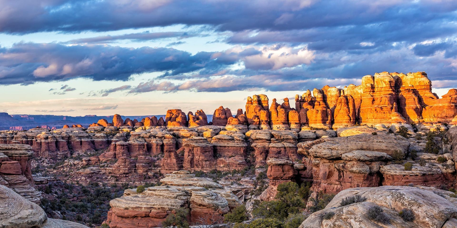
Needles District
Cedar Mesa Sandstone spires rise 400 feet from the canyon floor in banded red and white columns, striped by 300 million years of mineral deposit. The Needles is built around its trail system, with slot canyons that close to 18 inches across, open meadows ringed by rock formations, and one of the most distinctive backcountry experiences in Utah. 75 miles from Moab and worth every mile if you came here to hike. Day-use permits are required for most trails, including Chesler Park and the Joint Trail.
Maze District
Canyonlands' most remote wilderness. 46 miles of unpaved road from the nearest highway, no cell service, no casual entry point. A high-clearance 4WD vehicle is required, and the road washes out in rain. For experienced backcountry travelers, what waits after the drive is genuine solitude: branching canyon systems, walls streaked in reds and oranges and whites, and a landscape that has barely registered human presence. The least-visited district in the park by a wide margin, and that ratio is a function of access, not quality.
Raft Cataract Canyon with Moab Adventure Center
The Moab Adventure Center has run Cataract Canyon trips from Moab for decades. The logistics of a Cataract trip are not simple — the canyon requires an NPS river permit, specialized equipment, experienced guides who know the water level and rapid conditions for your trip date, and a return plan from a remote canyon exit. Moab Adventure Center handles every piece of this. Your job is to show up.
Two trip lengths are available. The right choice depends on how much time you have and how deep into the canyon experience you want to go
Journey 100 miles through remote red rock canyons with roaring whitewater & star-filled nights on this all-inclusive expedition from Moab to Lake Powell.
- Duration: 4 Days
- Departures: Weekly
- Season: Jun -Aug
ADULTS 16+
$2,050
YOUTH 10-15
$1,750
An epic, fast-paced, 2-day journey through Canyonlands National Park with roaring rapids, deep wilderness & star-filled nights on the Colorado River.
- Duration: 2 Days
- Departures: M, W, F
- Season: May - Jul
ADULTS 16+
$1,150
YOUTH 10-15
$1,150
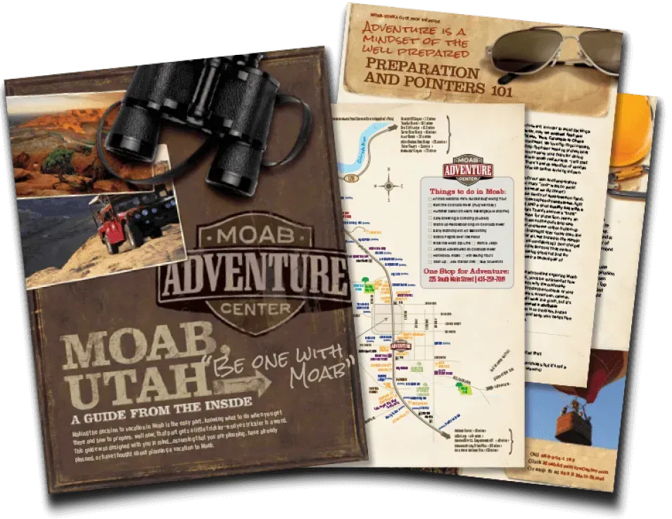
GET THE FREE MOAB INSIDER'S GUIDE!
Join our Moab Insider Email Series
and get our free Moab Insider's Guide
. It's your shortcut to where to stay, can't-miss adventures, recommended restaurants, hidden gems, and how to make the most of Arches & Canyonlands. Real local tips, easy itineraries, and expert advice so you can plan less and experience more
.
BECOME A MOAB INSIDER
With our Moab Insider's Gide and email series, you'll get local tips on the best dishes at restaurants, hidden adventures that most people miss, tips on when to visit, and a few more secrets on the side. Get all the essentials for the perfect Moab experience.
Free. Instant download. Unsubscribe anytime.
⭐️⭐️⭐️⭐️⭐️ 7,000+ 5-Star Reviews | 22-Time Best of State Winner