MOAB, UTAH >

Highway 313: Moab to Dead Horse Point Scenic Drive

Overview
Follow Highway 313, Moab’s gateway to the sky. This 22-mile scenic byway climbs from the red rock desert to panoramic overlooks above the Colorado River. Along the way, you’ll discover dinosaur tracks, Civil War–named buttes, and views that stretch for miles into Canyonlands. Whether you’re driving to catch a sunrise at Mesa Arch or a sunset at Dead Horse Point, this is one of Utah’s most unforgettable drives.
Quick Drive Summary
Distance: 22 miles each way (from Hwy 191 junction to Dead Horse Point)
Drive Time: 1.5–2 hours round trip with scenic stops
Road Type: Fully paved, two-lane highway suitable for all vehicles
Highlights: Moab Giants Dinosaur Museum, Monitor & Merrimac Buttes, Gemini Bridges, Dead Horse Point Overlook, Canyonlands Island in the Sky
Best Time: Early morning or sunset for vibrant color and long canyon shadows:
Getting There
From downtown Moab, head north on
US-191 for 16 minutes, then turn left onto
UT-313, clearly signed for
Dead Horse Point State Park and
Canyonlands National Park (Island in the Sky District). The road is fully paved and open year-round.
Highlights Along Highway 313

Moab Giants Dinosaur Museum
Step back in time at Moab Giants Dinosaur Museum! Located right at the junction of Highways 191 and 313, this interactive museum features stunning life-sized dinosaurs, a 3D theater, and fossil digs. Kids love exploring while parents bask in serenity knowing that these giant reptiles are extinct. A unique family-friendly stop on your way to adventure!
Monitor & Merrimac
Just minutes into your drive on paved Highway 313, you reach the Monitor and Merrimac Butte viewpoint. Or, choose the Monitor and Merrimac Loop Trail with a 4x4 vehicle, mountain bike, or your trusty hiking boots. Don't have time? Check it out from above with a
Scenic Airplane Tour or
Hot Air Balloon Ride.
Gemini Bridges 4x4 Route
An alternate, and very rugged 4x4 route, to Dead Horse Point climbs high above Hwy 191 towards a quick and careful walk across the Gemini Bridges and the gorge that drops out below them. Continue westward to link up with Hwy 313. Another alternate return route to Moab is down the infamous Shafer Trail - but be sure to plan accordingly!
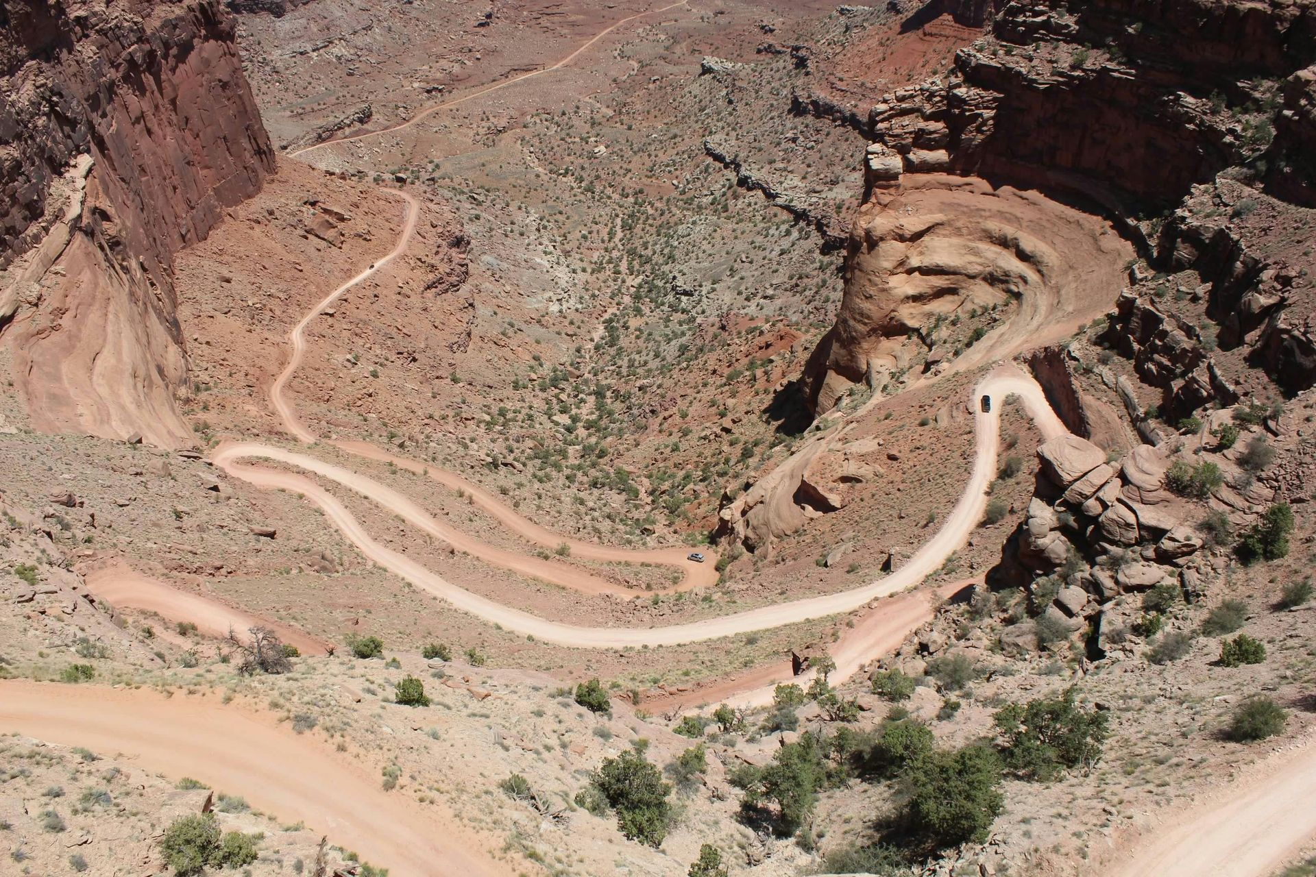
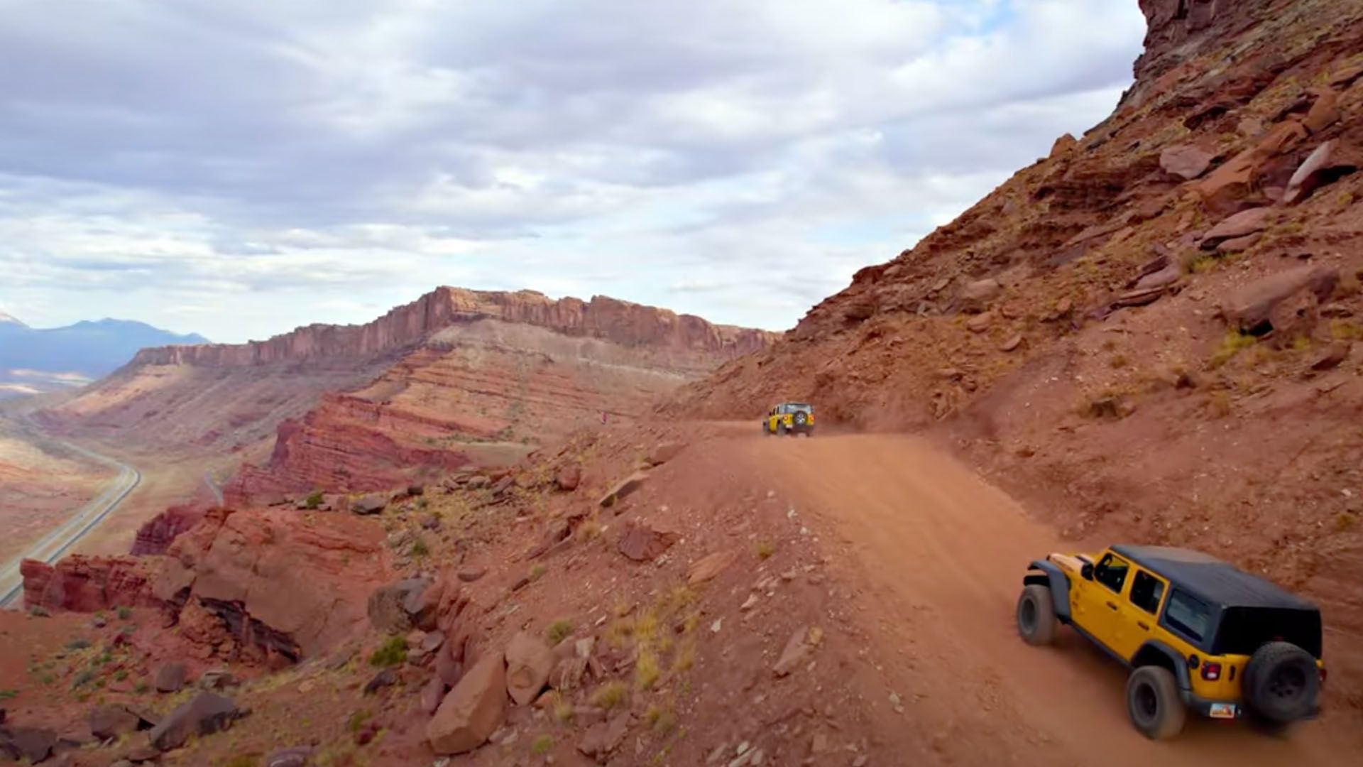
Shafer Trail 4x4 Route
The Shafer Trail winds down the face of a cliff from the Island in the Sky District of Canyonlands into the vast White Rim canyon country that sprawls below the rim and above the Colorado River. The feat of driving it alone is something to feel proud of, but the views will just keep coming around every corner. From the top down, you will need to hang a left toward Potash Road and Moab. Wilderness permits are required for the White Rim Trail.
Dead Horse Point Overlook
Drive 30 minutes along 313 and you'll find yourself 2,000 feet above the Colorado River. Experience a five mile loop hike or take a short walk to the viewpoint. Try our
guided mountain bike tour or take in the sights from above with a
scenic air tour.
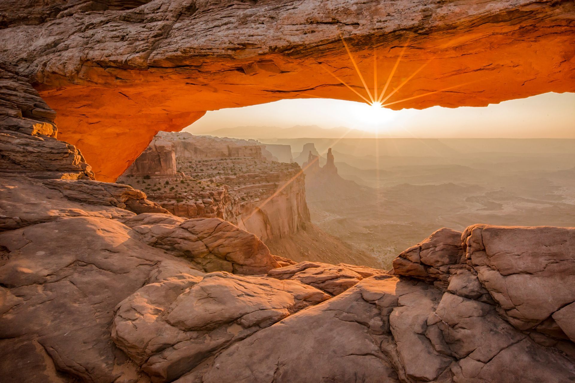
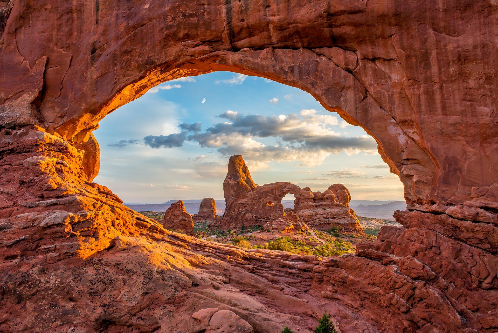
Mesa Arch (Canyonlands)
Mesa Arch is located just within the Canyonlands National Park boundary. The arch is just a short walk from the highway. Spectacular views always await, but photographers flock to this ideal sunrise location and jockey for position to get that well-timed shot of glory.
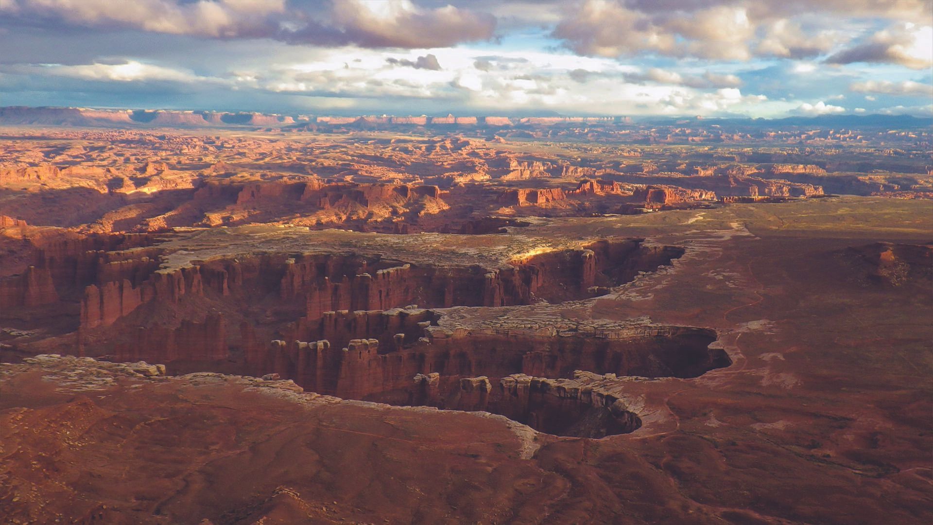
Grandview Point (Canyonlands)
Drive 30 minutes along 313 and you'll find yourself 2,000 feet above the Colorado River. Experience a five mile loop hike or take a short walk to the viewpoint. Try our guided mountain bike tour or take in the sights from above with a scenic air tour.
Why Travelers Love Scenic Byway 313 to Dead Horse Point
Utah Scenic Byway 313 is the road that leads you from Moab’s canyon floor to its rooftop. Fully paved and well-maintained, this winding highway climbs to sweeping mesas that frame the entrances to Canyonlands National Park and Dead Horse Point State Park. Each mile reveals a new panorama - towering buttes, distant arches, and the endless curves of the Colorado River far below.
Along the way, you’ll pass tempting side routes such as
Gemini Bridges Trail,
Long Canyon, and the
Shafer Trail switchbacks, rugged detours for those craving backcountry adventure. Whether you stay on the smooth asphalt or venture onto the dirt,
Highway 313 delivers the classic Moab mix of red-rock drama, desert solitude, and wide-open discovery.

Legends & Landmarks of Highway 313
Every turn on Highway 313 comes with a story. Some are legends, some are science, and a few are still up for debate. Why do they call such a breathtaking overlook Dead Horse Point? Who named two arches after the stars of Gemini? What in the geologic heck happened at Upheaval Dome?
Dead Horse Point: The Mirage of Water
Picture the early cowboys of the Old West rounding up wild mustangs across the mesa. They corralled the herd at the narrow neck of what’s now Dead Horse Point, fenced it off... and never came back. With no food or water, the horses perished within sight of the Colorado River glittering 2,000 feet below, so close, yet impossibly out of reach. Today, that haunting legend gives the overlook its name, a story that’s part tragedy, part cautionary tale, and all Moab myth.
Gemini Bridges: The Twin Bridges of Bull Canyon
Back in the 1950s, Moab rockhound and local legend
Lin Ottinger discovered two graceful natural bridges perched high above Bull Canyon. They stood side by side like perfect twins, so he named them Gemini, after the celestial pair Castor and Pollux. You can walk right across the top of these “twin bridges”, one for each star, with the canyon yawning below and the desert sky stretching above. It’s like crossing a piece of the cosmos, Moab-style.
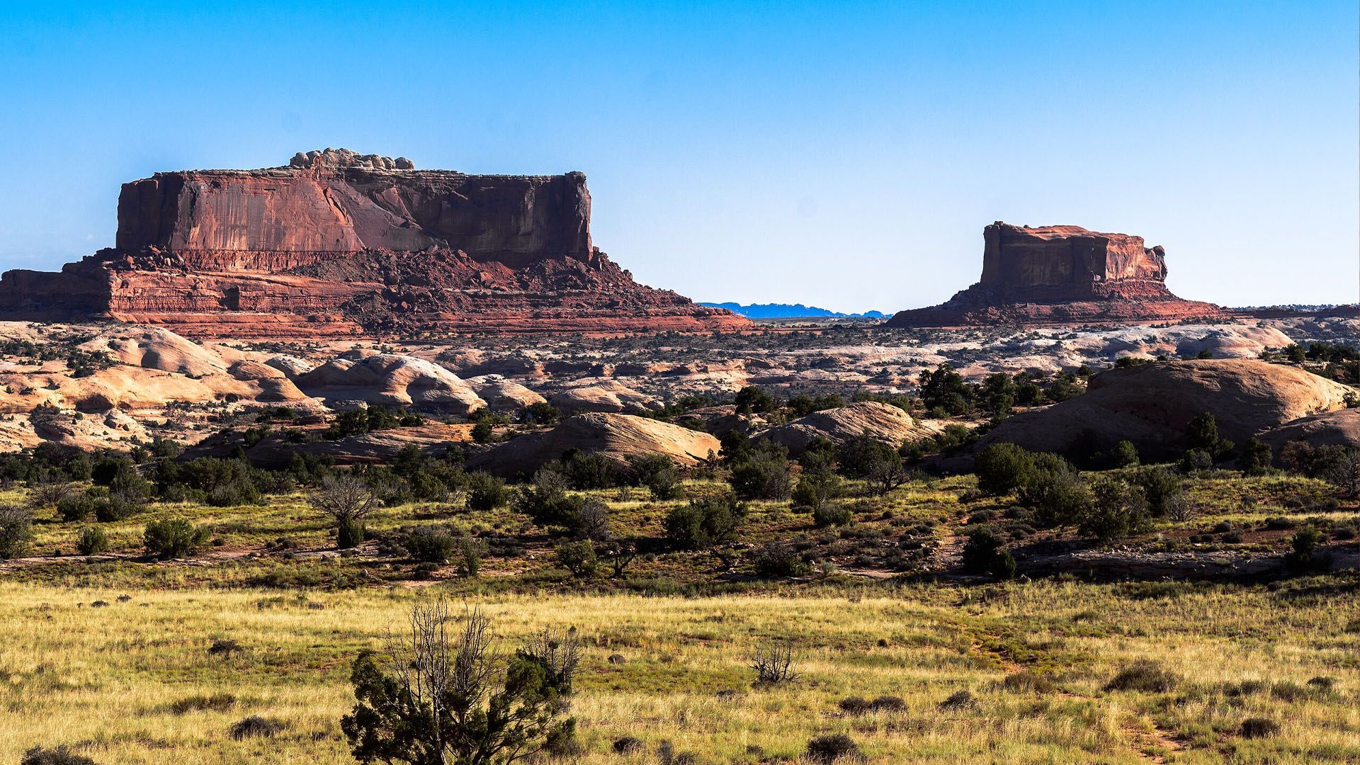
Monitor & Merrimac Buttes: The Stone Warships
Rising boldly from the desert north of Moab,
Monitor and Merrimac Buttes look like two stone warships eternally locked in battle on a sea of red sand. Early settlers and cowboys named them after the famous
ironclad ships of the Civil War—the USS Monitor and the CSS Merrimac—whose epic duel in 1862 changed naval history. The resemblance is uncanny: the flat-topped buttes face each other like rival vessels, their cliffs gleaming in the sun as if armored for another round. Out here, the war is long over, but the sandstone ships still stand their ground.
Upheaval Dome: Canyonlands Cosmic Mystery
High above the twisting canyons of Canyonlands lies
Upheaval Dome, a mystery crater that’s puzzled geologists for decades. Early explorers thought it was an ancient volcano; others swore it was the remnant of a cataclysmic explosion. Modern science leans toward a
meteor impact, but the jury’s still out — and the name fits either way. With rock layers bent, broken, and tossed upward like a cosmic splash,
Upheaval Dome looks every bit the part of Earth’s own red-rock bullseye — nature’s unsolved riddle in the heart of Canyonlands.
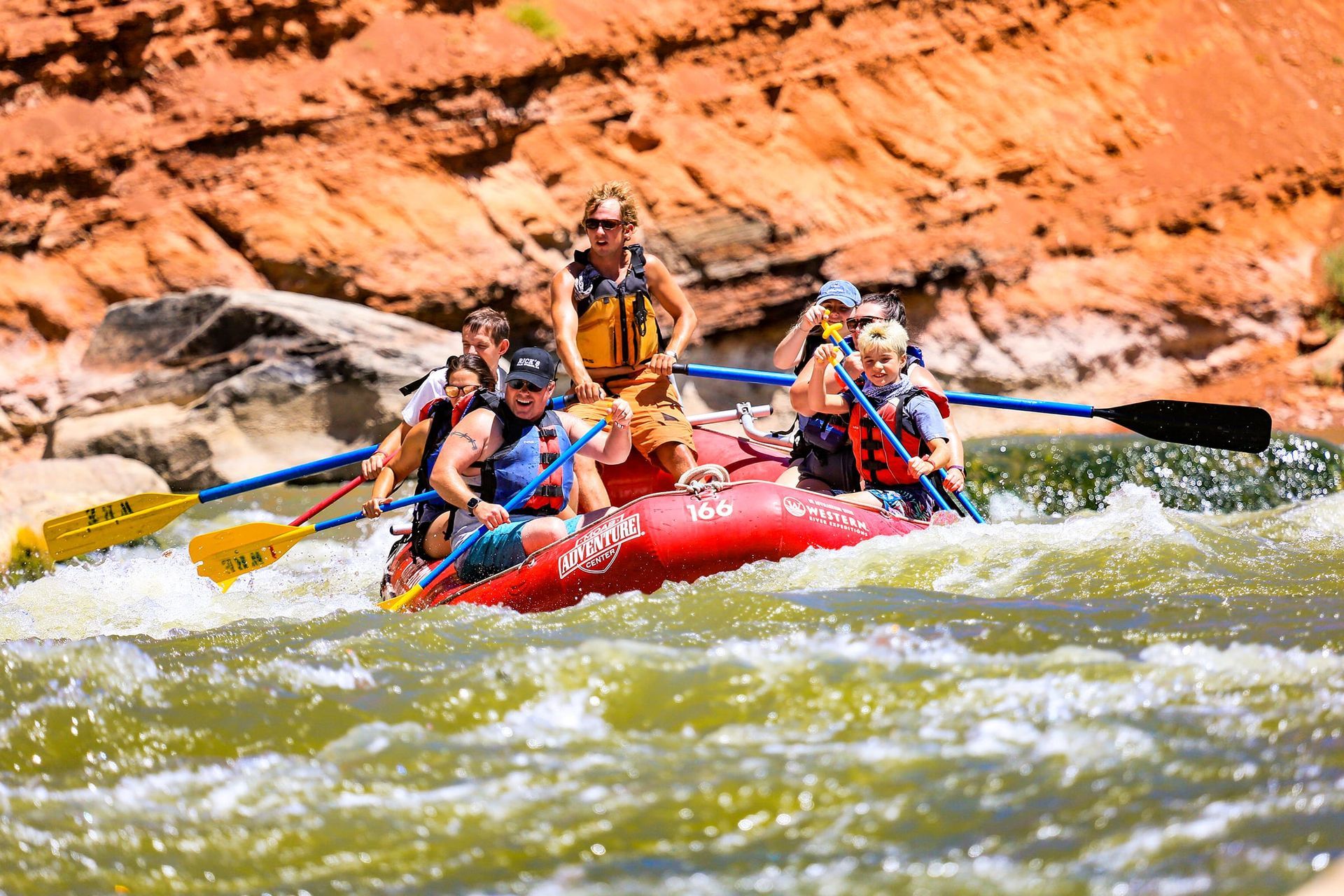
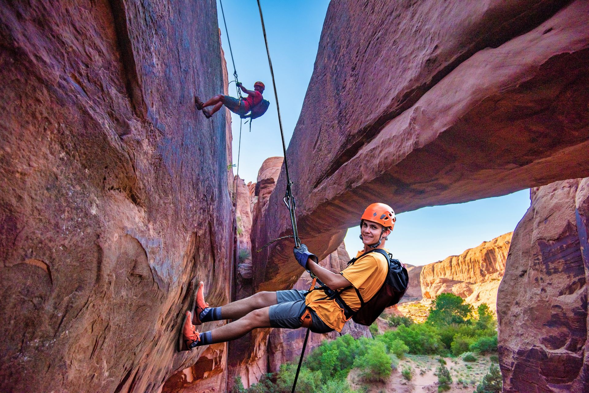
Tours to Enjoy Along Hwy 313
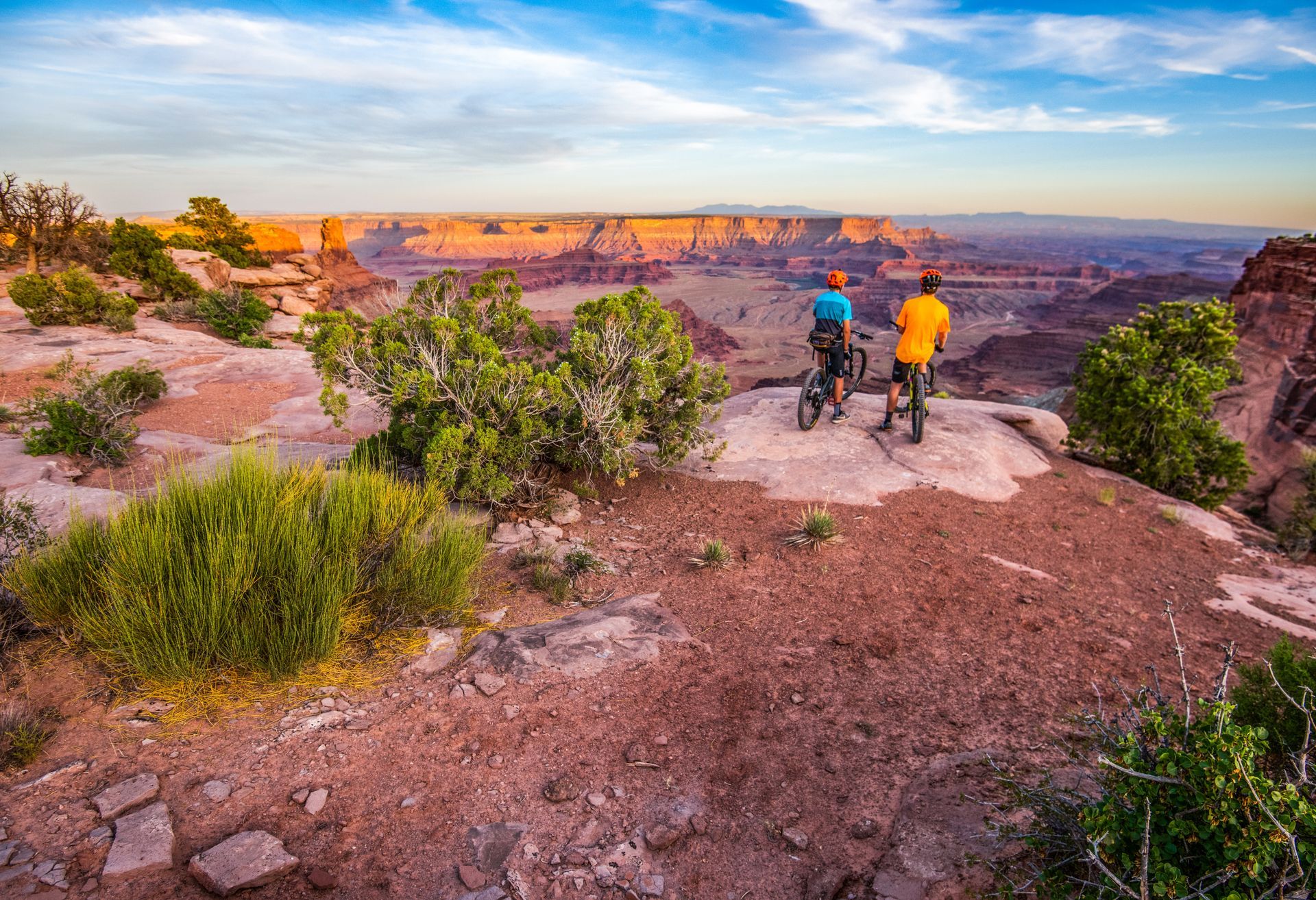
Ride to the edge of the world: Flowing singletrack, red rock rollers & jaw-dropping canyon overlooks on this intermediate 9-mile ride at Dead Horse Point State Park.
- Duration: ~4.5 hrs
- Departures: Varies
- Season: Mar - Nov
ADULTS 13+
$145YOUTH 12
$145
Explore Moab’s iconic trails on your terms: Premium 4x4 power, epic views & backcountry freedom without the crowds, schedules, or second-guessing your vehicle.
- Duration: ~10 hours
- Departures: 8AM to 6PM
- Season: Year Round
ADULTS 25+
$330 /day
GET THE FREE MOAB INSIDER'S GUIDE!
Join our Moab Insider Email Series
and get our free Moab Insider's Guide
. It's your shortcut to where to stay, can't-miss adventures, recommended restaurants, hidden gems, and how to make the most of Arches & Canyonlands. Real local tips, easy itineraries, and expert advice so you can plan less and experience more
.
BECOME A MOAB INSIDER
With our Moab Insider's Gide and email series, you'll get local tips on the best dishes at restaurants, hidden adventures that most people miss, tips on when to visit, and a few more secrets on the side. Get all the essentials for the perfect Moab experience.
Free. Instant download. Unsubscribe anytime.
⭐️⭐️⭐️⭐️⭐️ 7,000+ 5-Star Reviews | 22-Time Best of State Winner