MOAB, UTAH >

Potash Road Scenic Drive
Overview
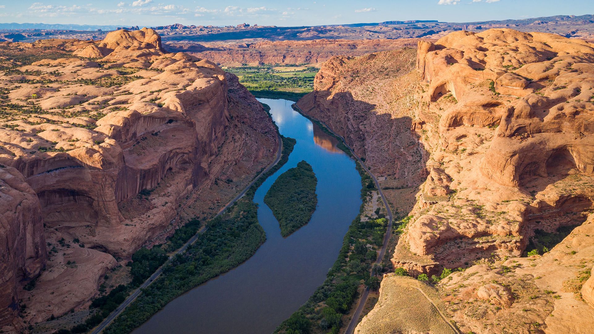
For 17 miles,
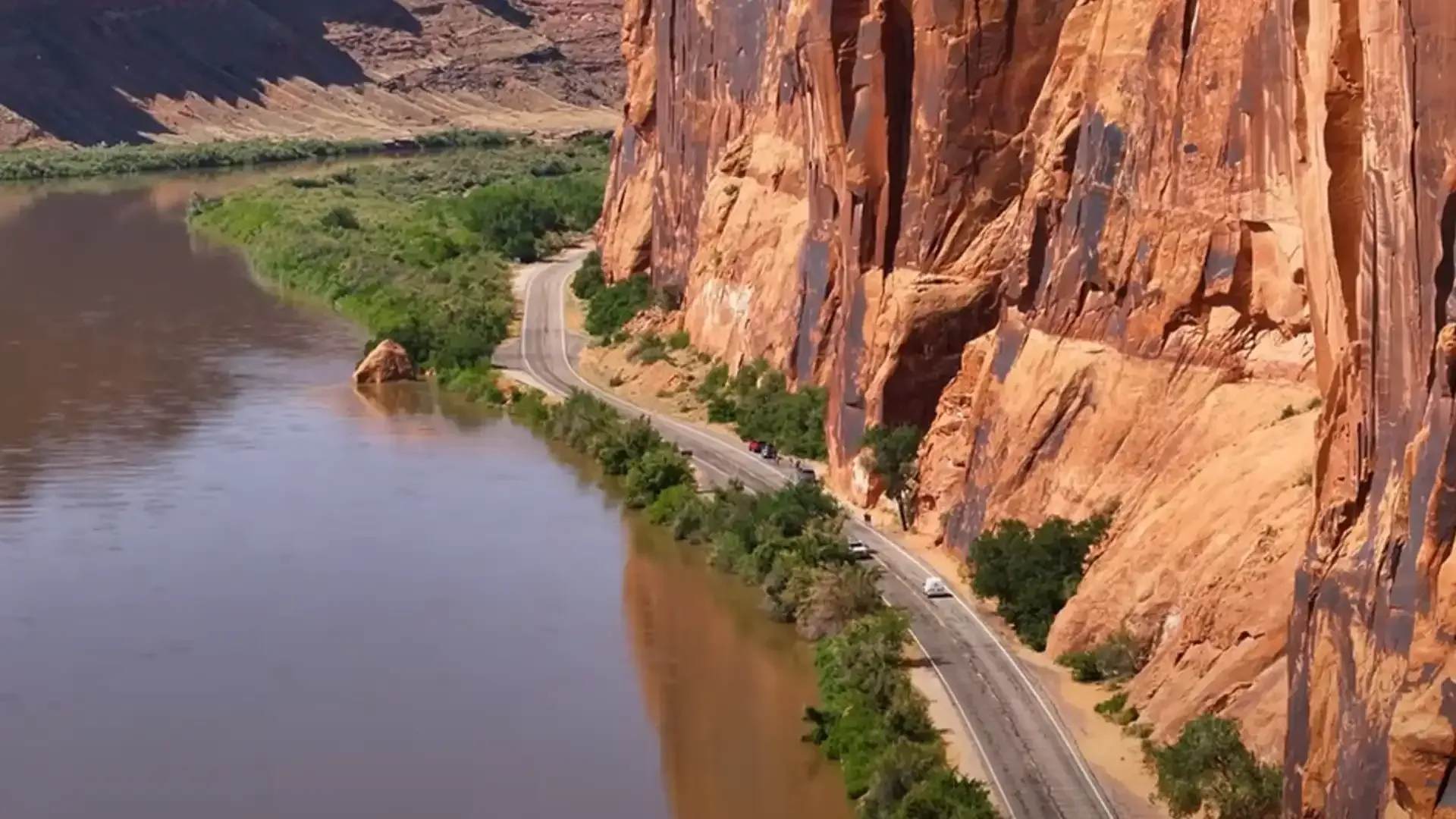
Potash Road (Utah Highway 279) traces the Colorado River between towering sandstone cliffs locals call Wall Street. This spectacular corridor reveals Moab’s layers of natural and cultural history, from prehistoric petroglyphs and dinosaur tracks to modern-day rock climbers scaling the same walls. The drive ends where pavement meets the
Potash Boat Ramp, the starting point for multi-day rafting trips into
Cataract Canyon and
Canyonlands National Park. Short, scenic, and packed with variety, Potash Road feels like a highlight reel of canyon country.
Quick Drive Summary
- Start: 4 miles north of downtown Moab – turn left onto UT-279 (Potash Road) just after crossing the Colorado River bridge.
- End:Potash Boat Ramp, about 16.5 mi from US-191; pavement ends here.
- Distance: ~34 mi round-trip
- Time: 1½–2 hours with brief stops
- Road Type: Smooth two-lane pavement, short graded dirt at the end
- Highlights: Petroglyphs, Wall Street cliffs, Corona Arch hike, Colorado River views
- Best Light: Early morning or late afternoon
- Route Map: View Route in Google Maps
Getting There
From downtown Moab, head north on US-191. After crossing the Colorado River bridge, drive about 2 minutes and turn left onto UT-279, clearly marked for “Potash.” The highway immediately drops beside the river and begins hugging the cliffs to the west.
Popular Tours Along Potash Road
On Potash Road you will see rock climbers taking on the challenge of Wall Street (when you're there you'll know why they call it that)! You may spot a jetboat or two making their run down or back again on these calmer waters of the Colorado River. At the Potash Boat Ramp you'll see where all Cataract Canyon rafting trips begin their 100-mile plunge into the heart of Canyonlands National Park. Hidden from sight, somewhere among the red rock cliffs and ledges there are canyoneers making their way adventurously through Bow & Arrow Canyon. If you've rented a rented a Jeep or Bronco for the day, Potash Road will become the Shafer Rail or vice-versa if you start from the bottom.
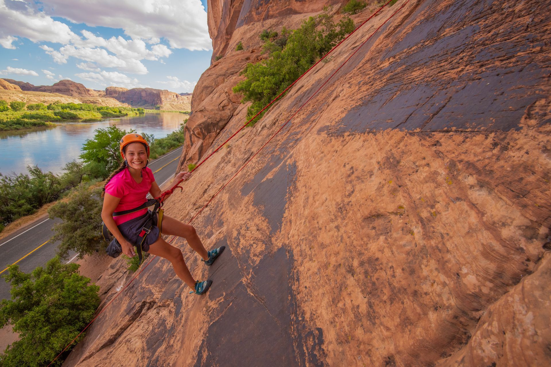
Learn to climb on Moab’s stunning sandstone: Real rock, real gear & expert coaching without fear, pressure. You'll feel like you belong among a group of rock climbers!
- Duration: ~5 hours
- Departures: AM & PM
- Season: Apr - Nov
ADULTS 13+
$155
YOUTH 5-12
$130
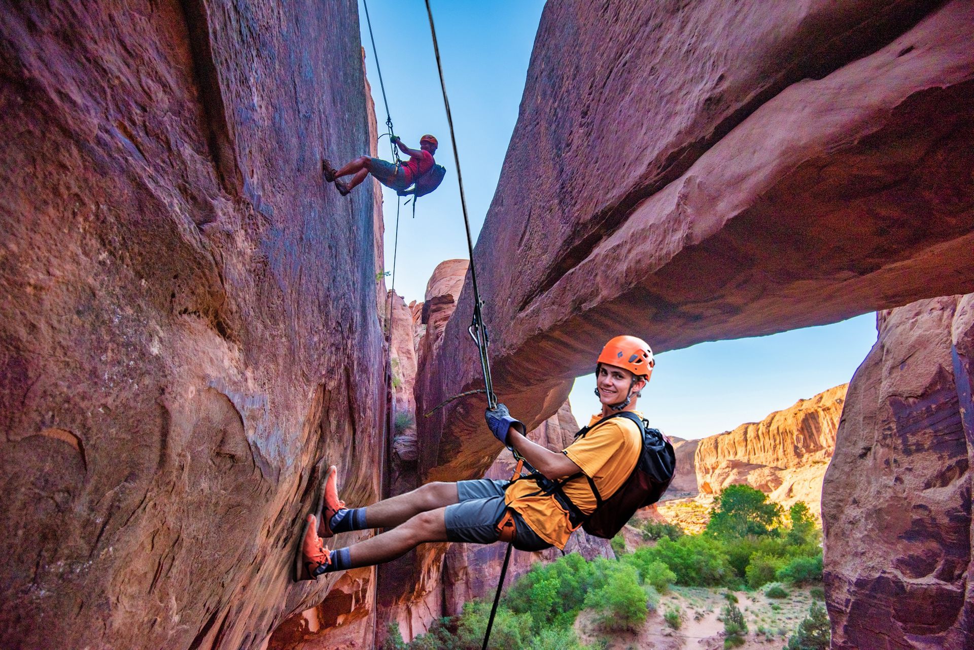
Hidden Moab adventure unlocked: Secret arches, ancient rock art, dino tracks, and thrilling rappels deep into a red rock wilderness that few will ever see.
- Duration: ~5 hours
- Departures: AM & PM
- Season: Apr – Nov
ADULTS 13+
$155
YOUTH 10-12
$130
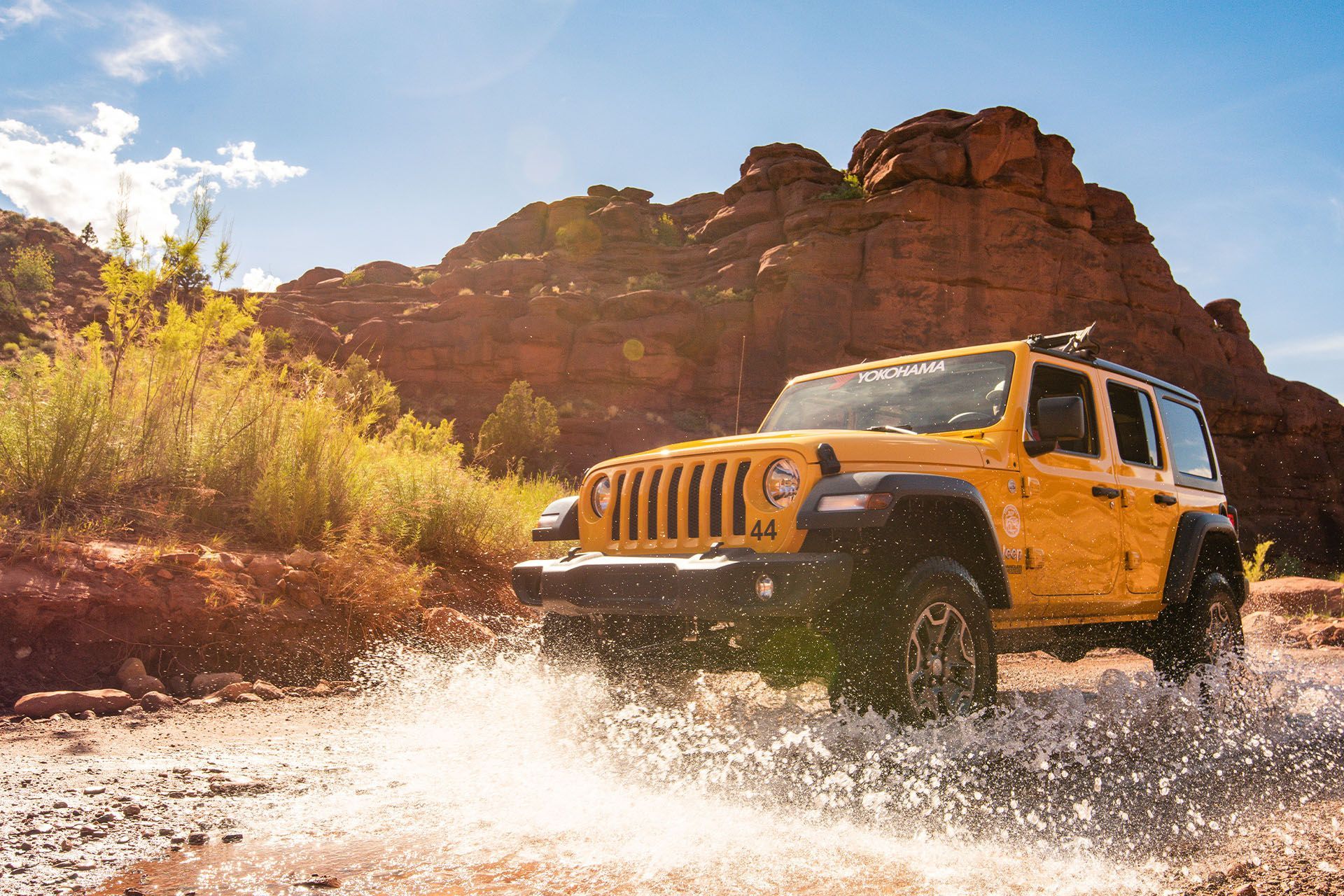
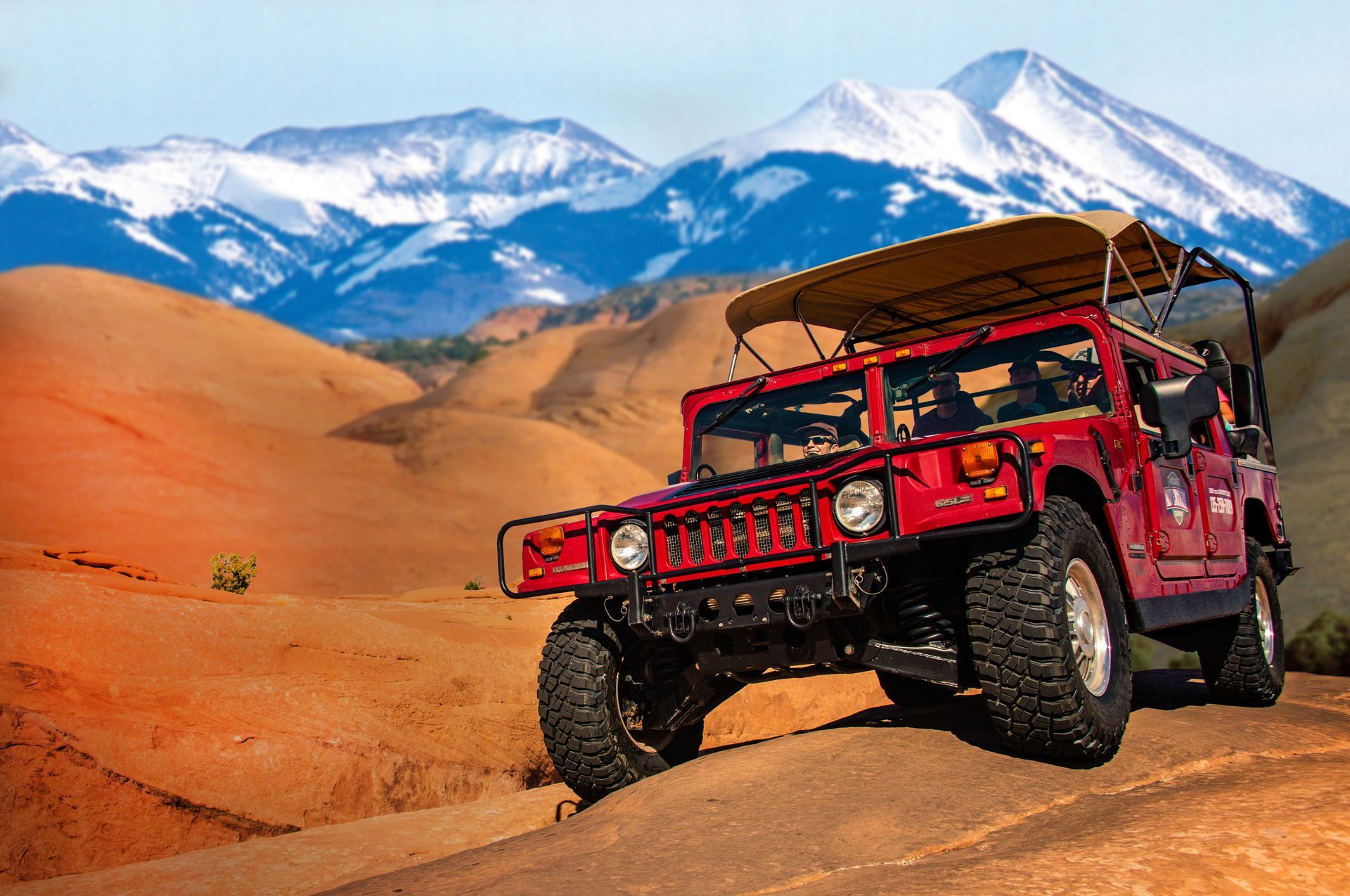
Explore Moab’s iconic trails on your terms: Premium 4x4 power, epic views & backcountry freedom without the crowds, schedules, or second-guessing your vehicle.
- Duration: ~10 hours
- Departures: 8AM to 6PM
- Season: Year Round
ADULTS 25+
$330 /day
Top Stops Along Potash Road
Mile 3.8 – Jaycee Park Campground & Portal Overlook Trail
This shaded picnic area and campground offer one of the area’s top hikes. The challenging
Portal Overlook Trail climbs roughly 2.5 miles to a breathtaking view of Moab and the river’s entrance into the canyon.
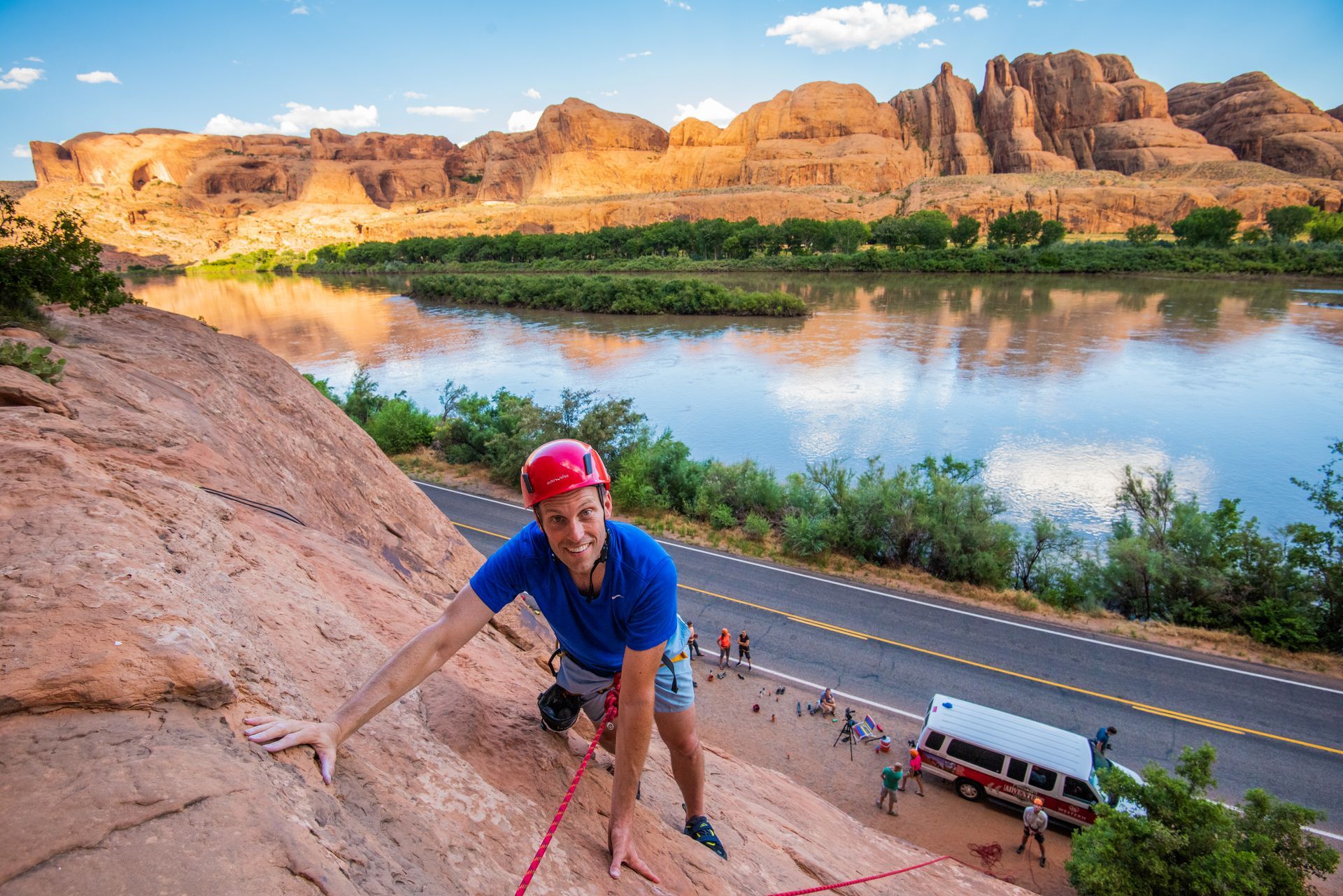
Mile 4.3 – Wall Street Climbing Area
For the next mile you’ll drive between a thousand-foot sandstone wall and the river. This is Wall Street, Moab’s most famous roadside climbing zone. Pull into one of the paved bays, roll down the windows, and watch climbers inch up routes with names like Knapping with the Alien, Morning Thunder, Dead Sea Route, and 30 Seconds Over Potash.
This convenient and spectacular location is where you can experience our
Introduction to Rock Climbing tours.
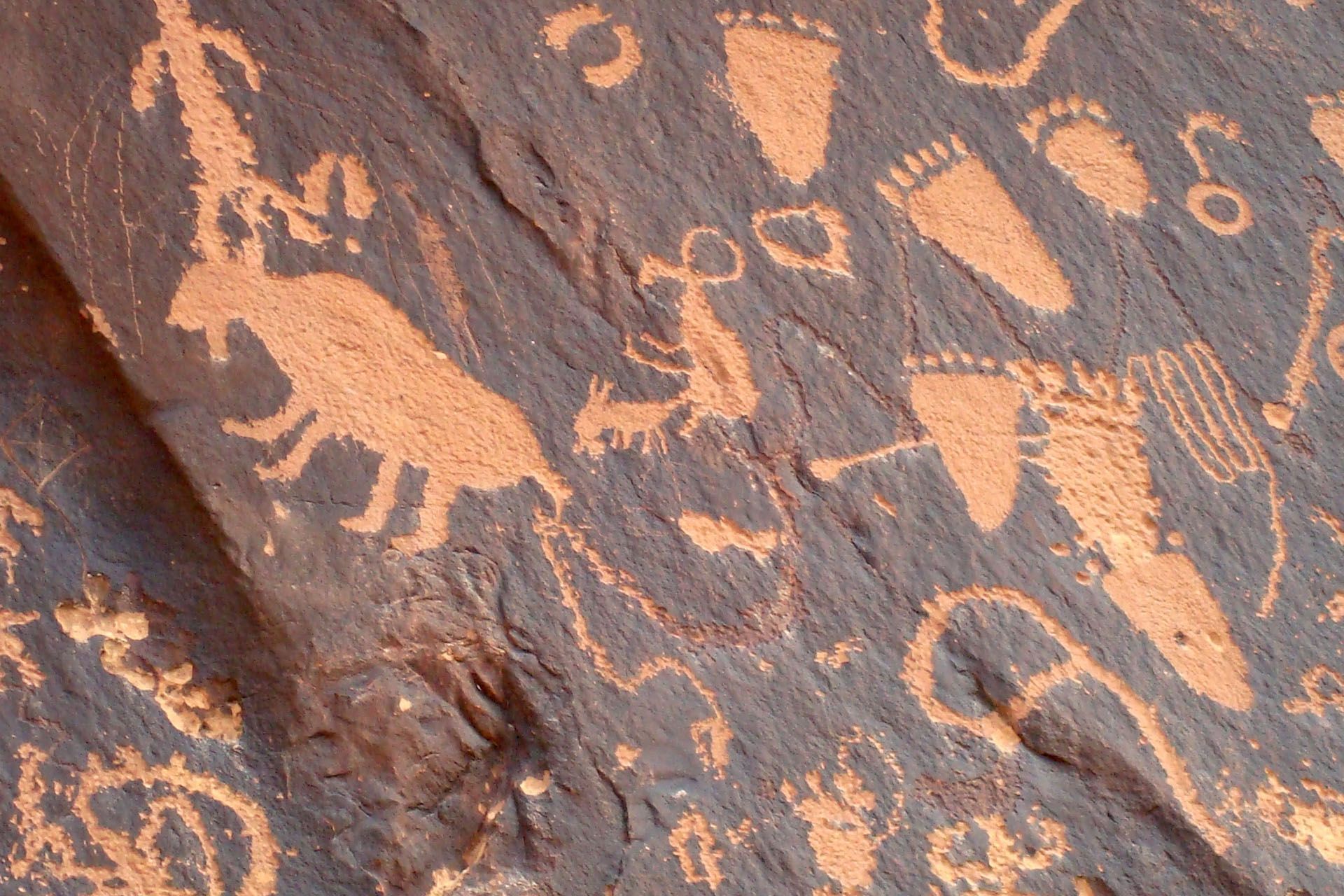
Mile 5.0 – Potash Road Petroglyphs
Look for the brown “Indian Writing” sign and small pullout. On the dark, varnished cliff are dozens of ancient carvings—bighorn sheep, hunters, spirals, and mysterious patterns. They’re high on the wall, so binoculars help. Stand quietly; it’s humbling to think these marks have faced the river for a thousand years.
Mile 5.9 – Poison Spider Trailhead & Dinosaur Tracks Viewpoint
Even if you’re not driving the 4×4 trail, stop here for the interpretive sign and metal viewing tubes pointing to fossilized
dinosaur tracks across the canyon. The three-toed prints belong to Jurassic-era meat-eaters—easily spotted when the light hits just right. See them as part of the
Bow & Arrow Canyon Canyoneering Adventure.
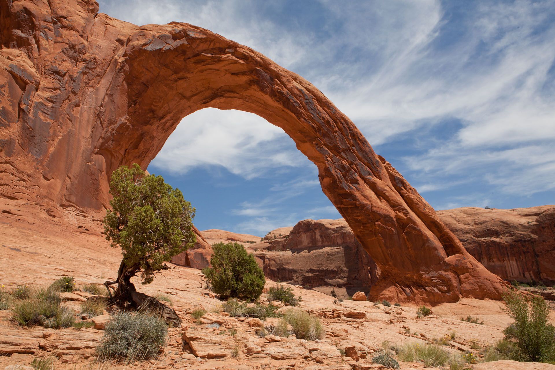
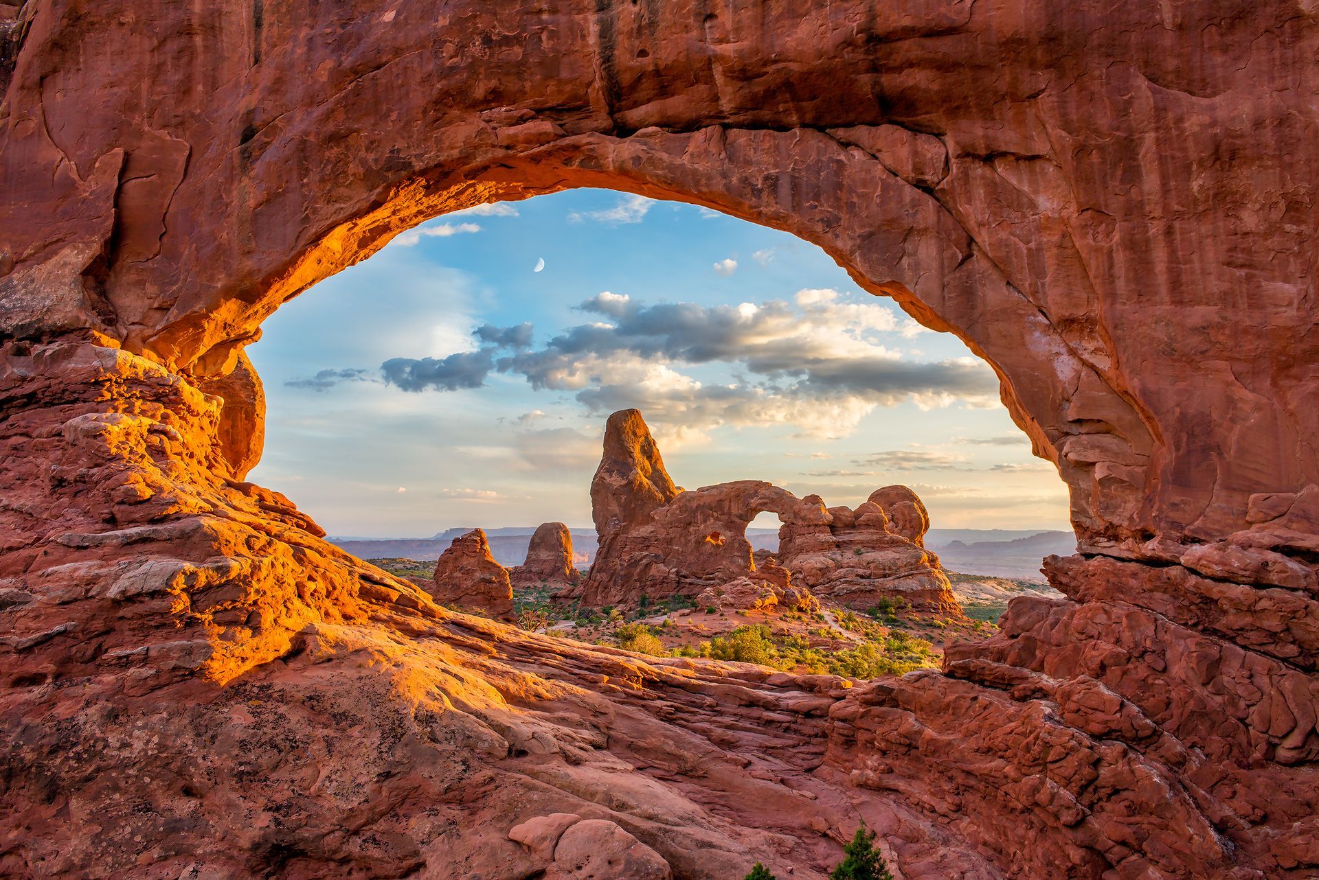
Mile 10 - Corona Arch Trailhead
One of Moab’s signature hikes outside the national parks, this 3-mile round-trip trail leads to
Corona Arch, a massive sandstone span rivaling those in Arches National Park. The hike takes 1.5–2 hours and offers incredible photo opportunities along the way.
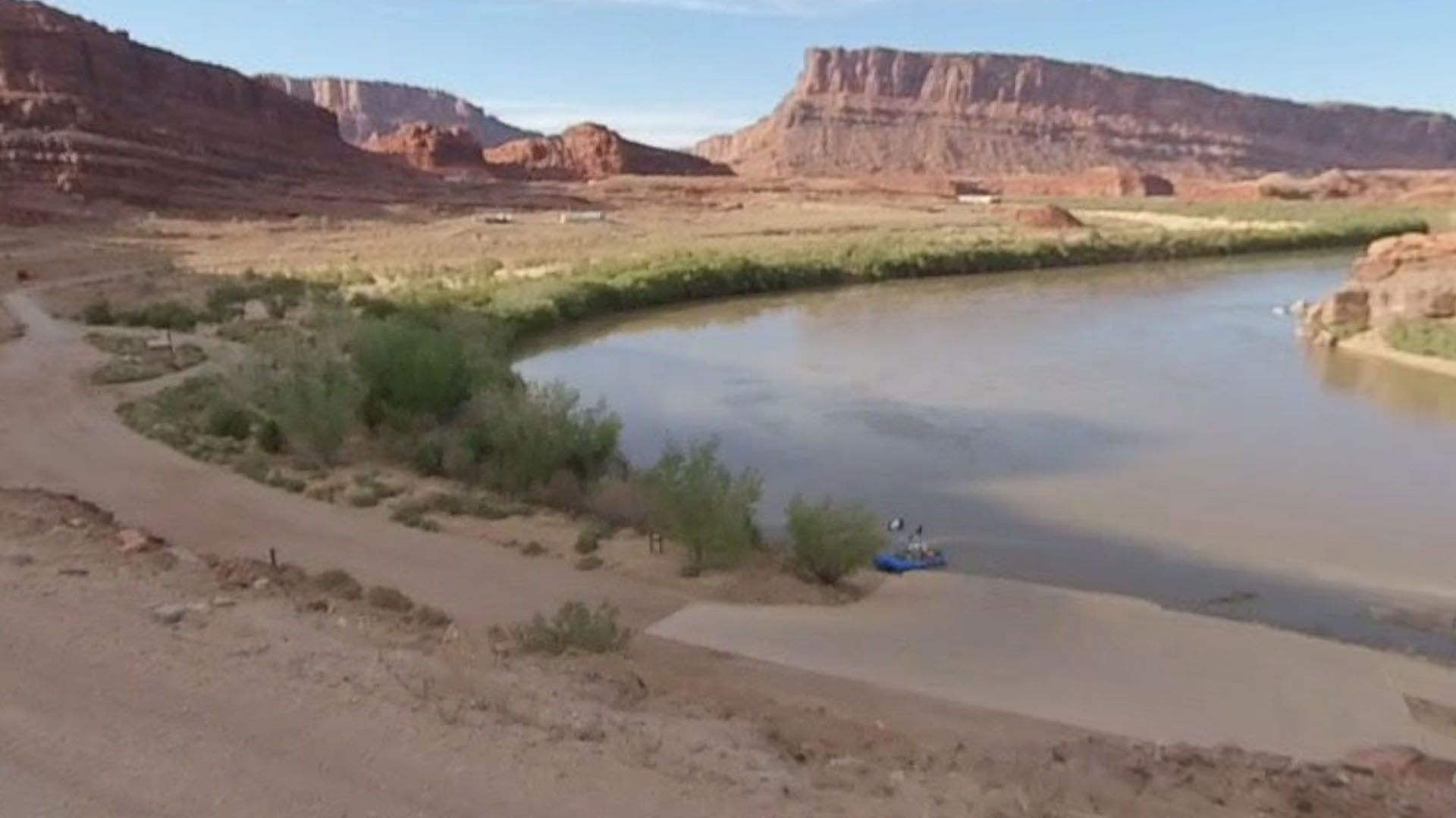
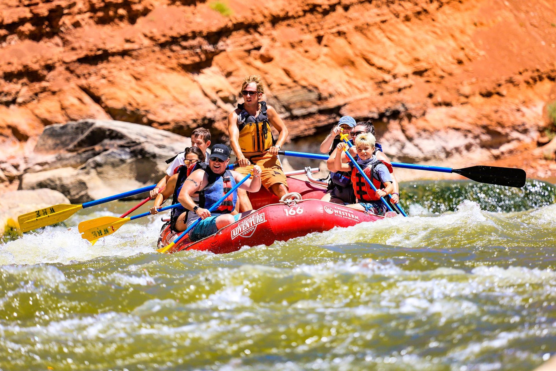
Mile 17 - Potash Boat Ramp
Here the paved road ends, opening to a wide river bend used by rafting outfitters. It’s the staging area for legendary multi-day
Cataract Canyon trips, where the Colorado River cuts deep through Canyonlands. Even if you’re not launching, it’s a peaceful place to rest and enjoy the canyon silence.
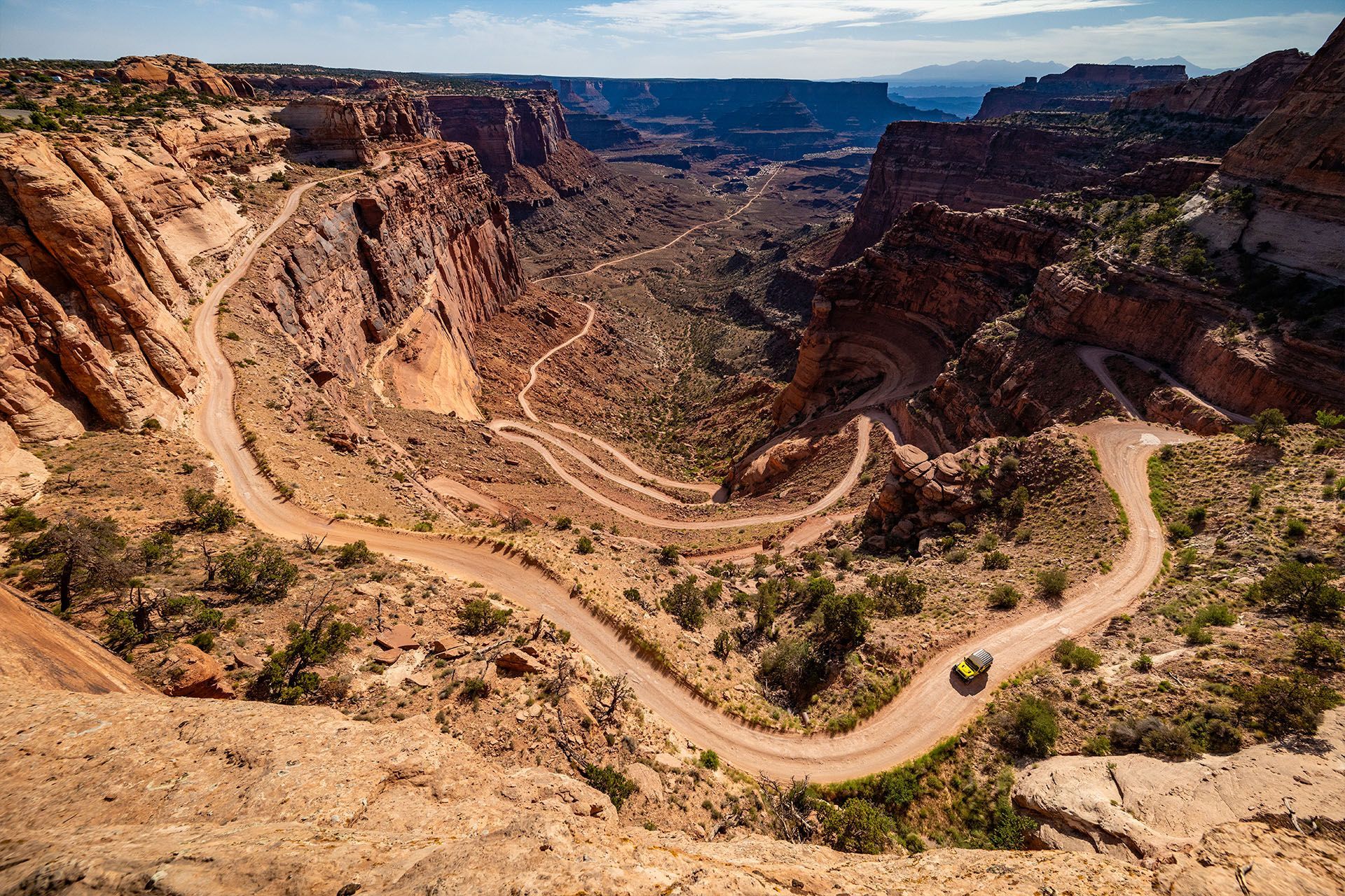
Mile 18 - Shafer Trail Connection (4x4 Vehicles Only)
Beyond the boat ramp, the road turns to graded dirt and connects to the
Shafer Trail—a steep, switchbacking 4×4 route climbing into Canyonlands’ Island in the Sky District. If you
rent a Jeep at Moab Adventure Center you can tackle trails like the Shafer Trail - recommended starting from the top via
Highway 313.
Tips for Driving Potash Road
- Start early: You'll have soft light and fewer cars. The cliffs face east.
- Bring binoculars: You’ll spot petroglyphs and climbers.
- Restrooms: Located at Jaycee Park, Corona Arch, and the Boat Ramp.
- Fuel up in Moab: There are no services on this road.
- Download maps: Open the Google maps link before leaving town. Cell service fades after mile 5.
Potash Road: Access to Miles of Spectacular Trails
Highway 279, also known as "Potash Road" is technically a dead end as far as pavement goes. At the Potash Boat Ramp the pavement ends, but 100 miles of access downstream through Canyonlands National Park begins. The dirt road that continues beyond the pavement leads to hundreds of miles of 4x4 trails like the tenuously carved Shafer Trail that climbs a thousand feet above to Island in the Sky District, or White Rim Trail (backcountry permit required) which traverses the rim of Canyonlands as carved out by the Colorado River.

GET THE FREE MOAB INSIDER'S GUIDE!
Join our Moab Insider Email Series
and get our free Moab Insider's Guide
. It's your shortcut to where to stay, can't-miss adventures, recommended restaurants, hidden gems, and how to make the most of Arches & Canyonlands. Real local tips, easy itineraries, and expert advice so you can plan less and experience more
.
BECOME A MOAB INSIDER
With our Moab Insider's Gide and email series, you'll get local tips on the best dishes at restaurants, hidden adventures that most people miss, tips on when to visit, and a few more secrets on the side. Get all the essentials for the perfect Moab experience.
Free. Instant download. Unsubscribe anytime.
⭐️⭐️⭐️⭐️⭐️ 7,000+ 5-Star Reviews | 22-Time Best of State Winner