MOAB, UTAH

The Needles District

Canyonlands’ "Serious" Hiking District
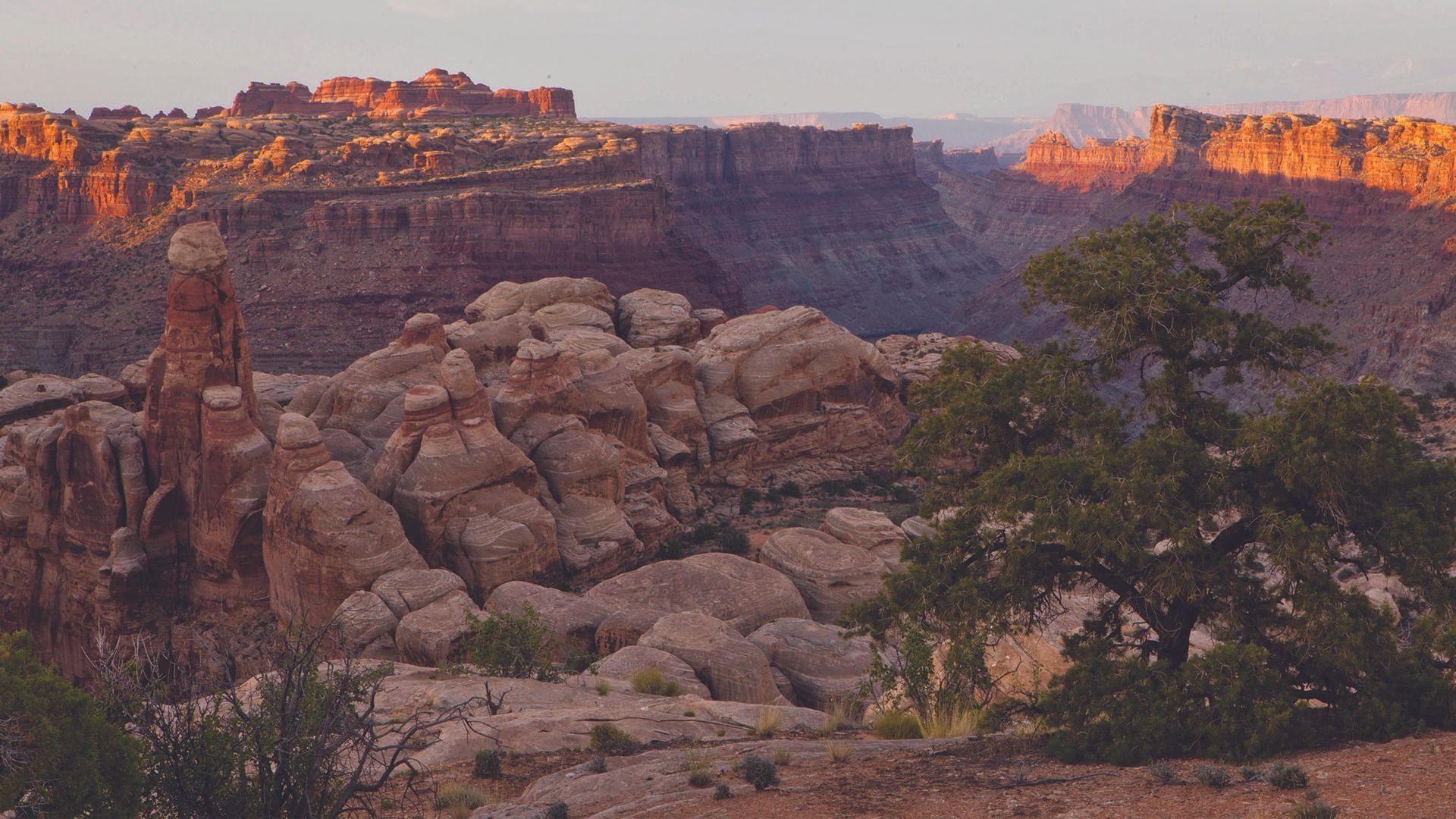
Cedar Mesa Sandstone towers rise 400 feet from the canyon floor in banded red and white columns, striped by 300 million years of mineral deposit. They cover thousands of acres of slickrock, slot canyons, and meadows that most visitors to Canyonlands never reach. That is the point. The Needles is where hikers go.
This district sits in the southeastern corner of Canyonlands National Park, 75 miles from Moab and worth every mile of the drive. It has the most technical and rewarding trail system in the park, a dedicated scenic byway on the approach, and a visitor center that actually helps you make the most of your time. If Island in the Sky is the overview, The Needles is the immersion.
This guide covers the trails, the permit system, the scenic drive, camping, and the realistic logistics of planning a visit from Moab.
Canyonlands National Park Quick Links
What is the Needles District?
The Needles takes its name from the Cedar Mesa Sandstone spires that define the landscape. The stone eroded into these columns over millions of years, and the distinctive red-and-white banding comes from alternating layers of iron oxide and calcium carbonate deposited when the area was a coastal floodplain.
The district covers the southeastern portion of Canyonlands and shares the park boundary with Bears Ears National Monument to the south. Unlike Island in the Sky, which is primarily a scenic drive with overlooks, The Needles is built around its trail system. The canyons, arches, and rock formations here require foot travel to reach, and the hiking ranges from a 0.6-mile family walk to strenuous multi-day backcountry routes.
The Needles Visitor Center is located at the park entrance and is staffed year-round with rangers who can advise on current trail conditions, permit availability, and campsite status.
GETTING TO THE NEEDLES DISTRICT
The Needles is 75 miles from Moab. The drive takes approximately 1.5 hours on paved roads. It is not a quick side trip — plan accordingly. Most visitors who do it as a day trip from Moab leave early and commit the full day.
Driving Directions from Moab
From downtown Moab, head south on US-191 for approximately 40 miles to the junction with UT-211. Turn right (west) onto UT-211 and follow it 35 miles to the park entrance. The Needles Scenic Byway begins at this turn and runs the full length of UT-211 to the visitor center. The road is paved and accessible by any vehicle.
PARK HOURS & PASSES
- Open all year, 24 hours/day
- 7-day passes $35 per vehicle
- America the Beautiful annual pass covers entry for $80/year
- Day-use hiking permit required for most trails
- Backcountry permit required for all overnight camping. Limited availability; reserve well in advance for spring and fall.
">
The Needles Scenic Drive
Before you reach the park entrance, UT-211 itself is worth the trip. The Needles Scenic Byway runs 35 miles from US-191 to the visitor center and is one of the more striking approach roads in the national park system. The route passes through the canyon country of Newspaper Rock State Historic Monument, home to one of the largest petroglyph collections in the Southwest, and opens into sweeping views of the spires as you approach the park.
Newspaper Rock is a free stop, 12 miles west of US-191, and well worth 20 minutes. The rock panel contains more than 650 petroglyphs carved over 2,000 years by multiple Native American cultures. No admission fees and no permits required.
From Newspaper Rock, the road continues west through pinyon-juniper terrain before the Needles formations come into full view on the final approach to the entrance station.
Top Hikes in the Needles District
The Needles trail system is the primary reason to make the drive. The routes here involve slickrock scrambling, slot canyon narrows, and dramatic open meadows ringed by the spires. Trail distances below are round-trip unless noted.
Chesler Park Loop
Chesler Park is the Needles’ signature hike and the one most backcountry visitors build their trip around. The 11-mile loop circles a broad, grass-covered meadow that sits completely surrounded by the red-and-white spires. The trail involves slickrock scrambling, joint trail narrows, and route-finding across open stone. A day-use permit is required. Most hikers combine this with the Joint Trail for an 11-mile loop that covers both the meadow and the slot canyon section.
Joint Trail
The Joint Trail passes through a series of slot canyons where the walls close to 18 inches apart and the floor drops into shadow. The trail is 5.4 miles and is most commonly hiked as part of the Chesler Park loop, though it stands alone as one of the most distinctive trails in Utah. A day-use permit is required. Bring a headlamp for the deepest sections.
Cave Spring Trail
Cave Spring is the best option for visitors with young children or limited mobility. The 0.6-mile loop passes a working cowboy camp that has been in operation since the late 1800s and a panel of Ancestral Puebloan rock art and handprints. Two short ladders assist with a brief slickrock section. No permit required.
| TRAIL | DISTANCE | DIFFICULTY | HIGHLIGHT |
|---|---|---|---|
| Cave Spring Trail | 0.6 mi (loop)mi | Easy | Cowboy camp ruins and Ancestral Puebloan rock art; best option for families |
| Slickrock Foot Trail | 2.4 mi (loop) | Easy-Moderate | Panoramic views of the spires and canyon country; good terrain introduction |
| Pothole Point Trail | 0.6 mi (loop) | Easy | Unique rock potholes and wide open views; best after rain when pools fill |
| Elephant Hill Routes | 2.0 mi+ | Moderate | Gateway to most backcountry; short day hikes accessible from the trailhead |
| Joint Trail | 5.4 mi | Mod–Strenuous | Slot canyon narrows as tight as 18 inches; the most memorable trail in the district |
| Chesler Park Loop | 11 mi (loop) | Strenuous | The signature Needles hike: meadow surrounded by spires, combined with Joint Trail |
| Druid Arch | 11 mi | Strenuous | Remote free-standing arch via Elephant Hill; full-day commitment with significant gain |
| Lost Canyon | 8.7 mi (loop) | Strenuous | Remote loop with canyon bottom travel; less trafficked than Chesler Park |
Needles Overlook (Outside the Park)
Needles Overlook is a Bureau of Land Management viewpoint located off US-191, roughly 25 miles south of Moab and before the UT-211 turnoff. It is not part of Canyonlands National Park, requires no entrance fee, and provides a sweeping elevated view across the canyon country toward the Needles formations in the distance.
The overlook is a worthwhile stop if you are driving south toward the park. It is not a replacement for the experience inside the district, but it gives a useful orientation to the scale of the terrain before you reach the entrance. Access is via a short paved road off US-191; the site has a parking area and interpretive panels.
Best Time to Visit the Needles District
Spring (mid-March through May) and fall (September through October) are the best windows for hiking The Needles. Temperatures stay moderate, water sources in the backcountry are more reliable, and the light on the spires in morning and late afternoon is as good as it gets anywhere in Utah.
Summer (June through August) is viable with adjusted expectations. The slot canyons and canyon bottoms hold heat and have little airflow, so plan for early starts and be off the trail by noon.
Flash flood risk increases significantly with monsoon activity from late July through September. Check the weather before entering any slot canyon.
Winter visits are possible and uncrowded, but some campsites close and the access road can have brief closures after snow. Call the visitor center before making the drive in January or February.

Frequently Asked Questions About The Needles
How far is The Needles from Moab?
The Needles district is 75 miles from Moab, approximately 1.5 hours by car. Head south on US-191 to the UT-211 junction, then west on UT-211 to the park entrance. The entire drive is paved.
Do you need a permit to hike in The Needles?
Yes. A day-use hiking permit is required for most trails in The Needles, including Chesler Park and the Joint Trail. Permits are reserved in advance through recreation.gov. The entrance fee or annual pass is separate from the hiking permit. Cave Spring Trail and a few short nature walks near the visitor center do not currently require a day-use permit.
What are the best hikes in The Needles?
Chesler Park Loop (11 miles, strenuous) is the defining Needles hike: a meadow surrounded by spires, combined with the Joint Trail slot canyon. For a shorter option, the Slickrock Foot Trail (2.4 miles) provides wide views with moderate effort. Cave Spring (0.6 miles) is the best choice for families or visitors with limited time.
What is the difference between Island in the Sky and The Needles?
Island in the Sky is Canyonlands’ most accessible district, with a paved road, short overlook trails, and panoramic views from a mesa top. It is 32 miles from Moab and works as a half-day visit. The Needles is 75 miles from Moab and built around hiking. It requires permits, more planning, and a longer drive, but delivers a more immersive and technical backcountry experience. The two districts do not connect by road inside the park.
Is there camping at The Needles?
Yes. Squaw Flat Campground inside the park has 26 sites with water and flush toilets; reservations are required through recreation.gov and fill quickly in spring and fall. The Needles Outpost, just outside the entrance, offers additional campsites with hookups and limited services. Backcountry camping requires a separate permit.
Is Needles Overlook the same as The Needles in Canyonlands?
No. Needles Overlook is a free BLM viewpoint off US-191, about 25 miles south of Moab. It provides a distant view toward the Needles formations but is not part of Canyonlands National Park and does not provide access to the trails or visitor center. The Needles district entrance is an additional 35 miles west on UT-211.
Is The Needles worth visiting?
For serious hikers, yes. The Needles offers the most technically varied and visually rewarding trail system in Canyonlands. The 75-mile drive from Moab is a real commitment, but visitors who make the trip consistently call it the best hiking they did in Utah. If your goal is scenery from a car, Island in the Sky is a better fit. If you want to hike into the canyon, The Needles is the right district.
Not finding what you're looking for?
Rivers District
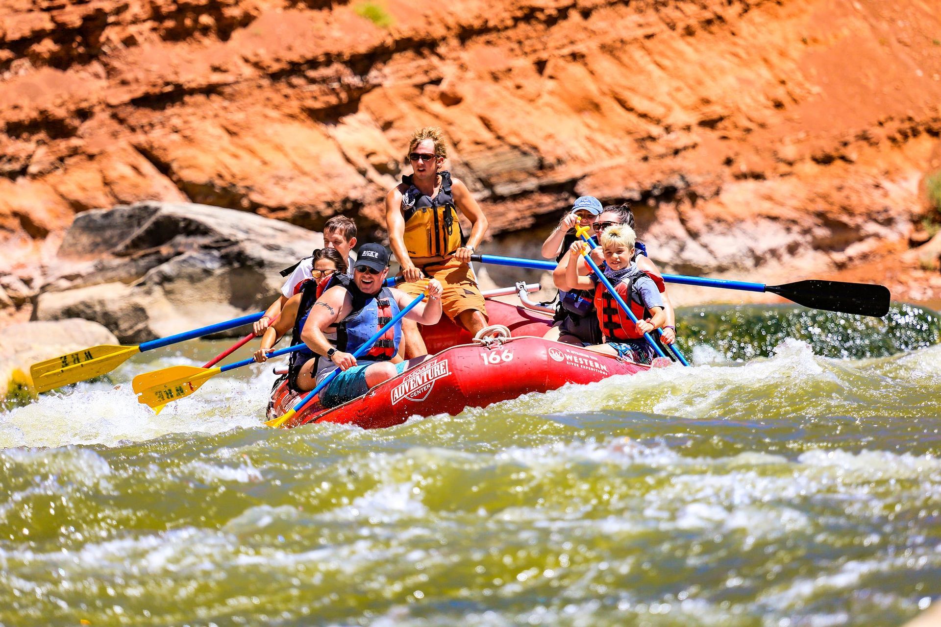
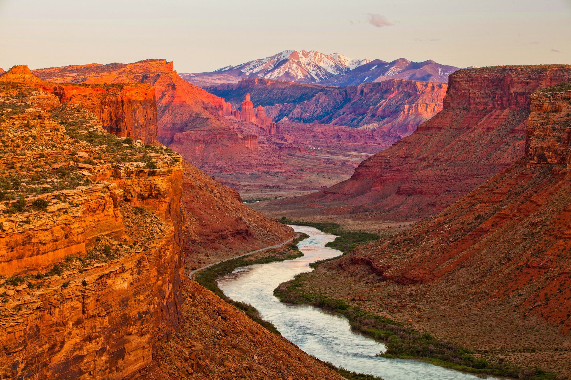
The canyon corridor at the heart of Canyonlands, where the Colorado and Green Rivers meet at The Confluence and drop into the whitewater of Cataract Canyon below. No roads reach this district. You arrive by raft or by air. Most park visitors stand at the rim and look down. Moab Adventure Center's guests float through the bottom, past 14 miles of named rapids, the Big Drop sequence, and the canyon walls that frame the park from below. The deepest, quietest, and most dramatic section of Canyonlands.
Island in the Sky District
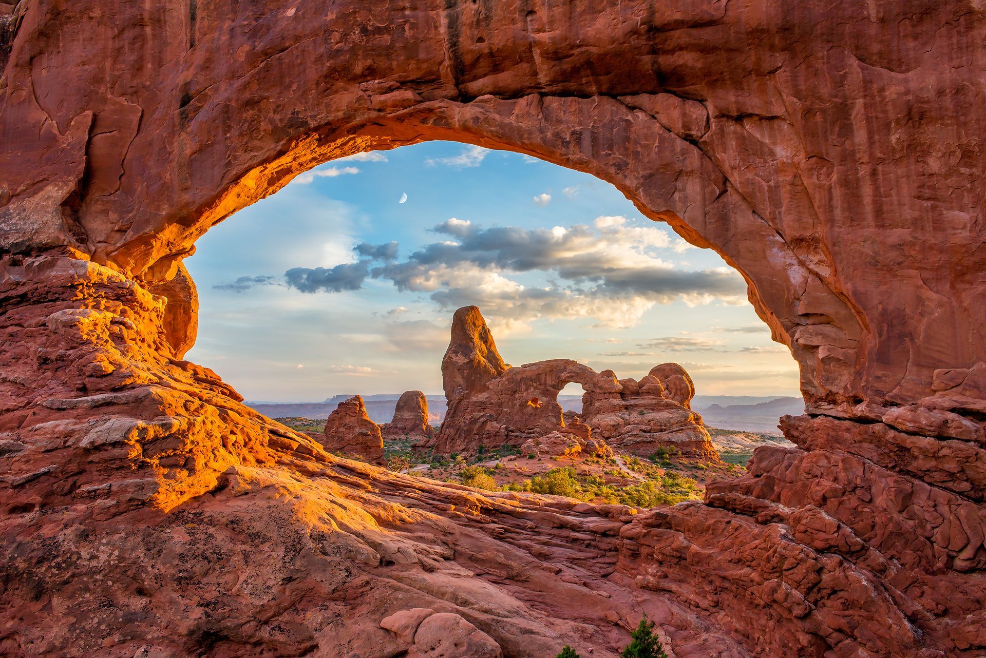
The most accessible district in Canyonlands, 32 miles from Moab on a paved road. Stand at Grand View Point and the ground drops a thousand feet in every direction, with views reaching 100 miles on a clear day. Mesa Arch frames the La Sal Mountains at sunrise, glowing orange when canyon-reflected light hits the underside. Upheaval Dome holds a 3-mile-wide crater whose origin still puzzles geologists. If you only have one day in Canyonlands, this is the district that delivers the iconic views with the least effort.
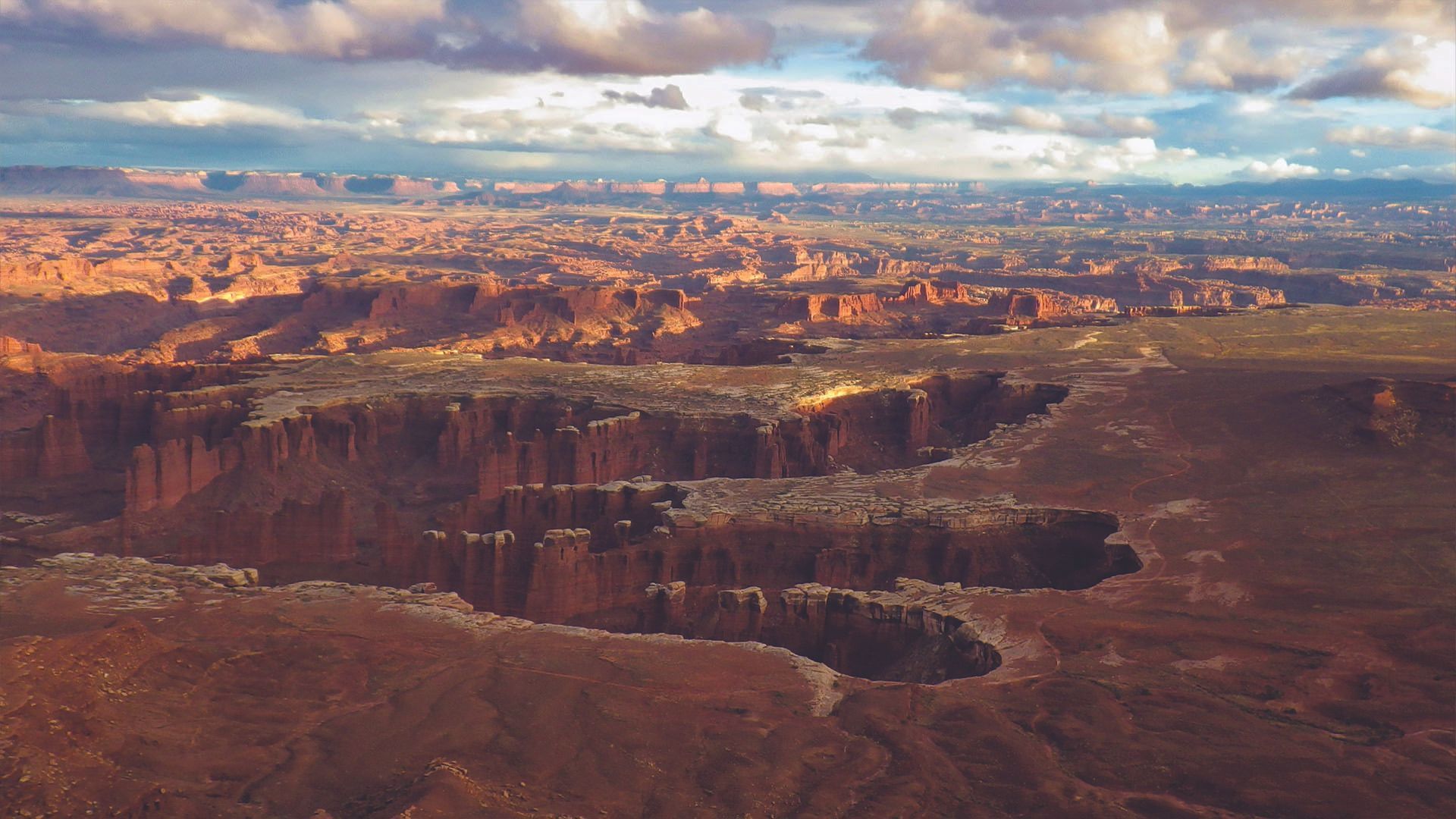
Maze District
Canyonlands' most remote wilderness. 46 miles of unpaved road from the nearest highway, no cell service, no casual entry point. A high-clearance 4WD vehicle is required, and the road washes out in rain. For experienced backcountry travelers, what waits after the drive is genuine solitude: branching canyon systems, walls streaked in reds and oranges and whites, and a landscape that has barely registered human presence. The least-visited district in the park by a wide margin, and that ratio is a function of access, not quality.
Explore Canyonlands with Moab Adventure Center
Moab Adventure Center does not offer guided tours into The Needles district. This part of the park is remote, permit-dependent, and best experienced on foot at your own pace.
If you want a guided Canyonlands experience, Moab Adventure Center operates two different angles on the park: trough scenic air tours and multi-day rafting trips through Cataract Canyon.
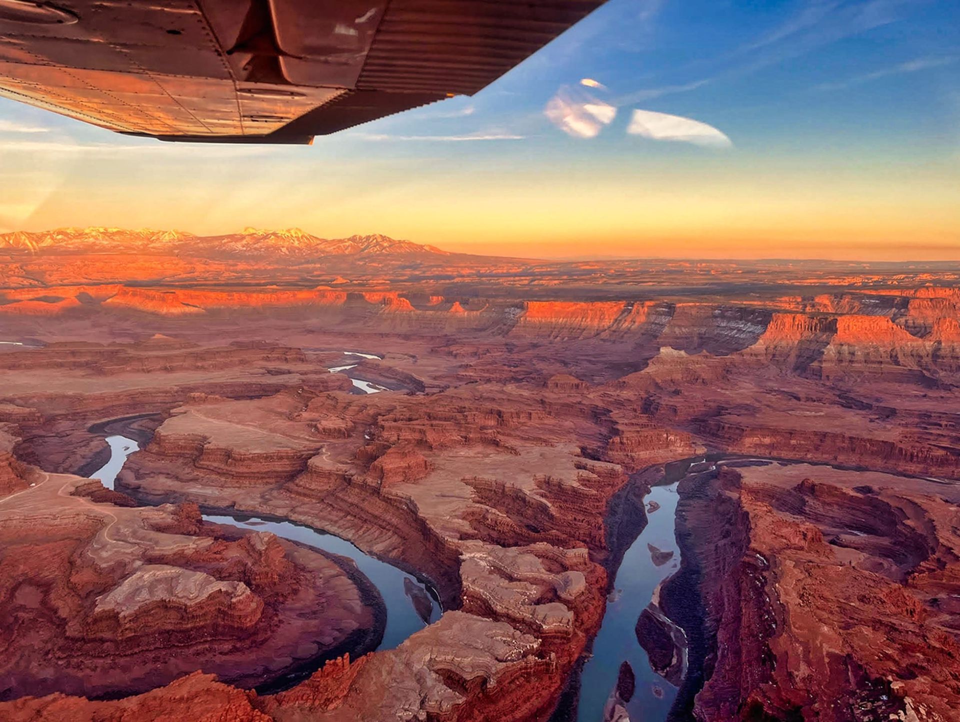
Canyon country like you’ve never seen it: Soar over remote arches, deep canyons, and the vast beauty of the Needles District. All at the perfect time of day.
- Duration: ~1 hour
- Departures: 1 hour before sunset (changes seasonally)
- Season: Year round
ADULTS 13+
$374
YOUTH 3-12
$374
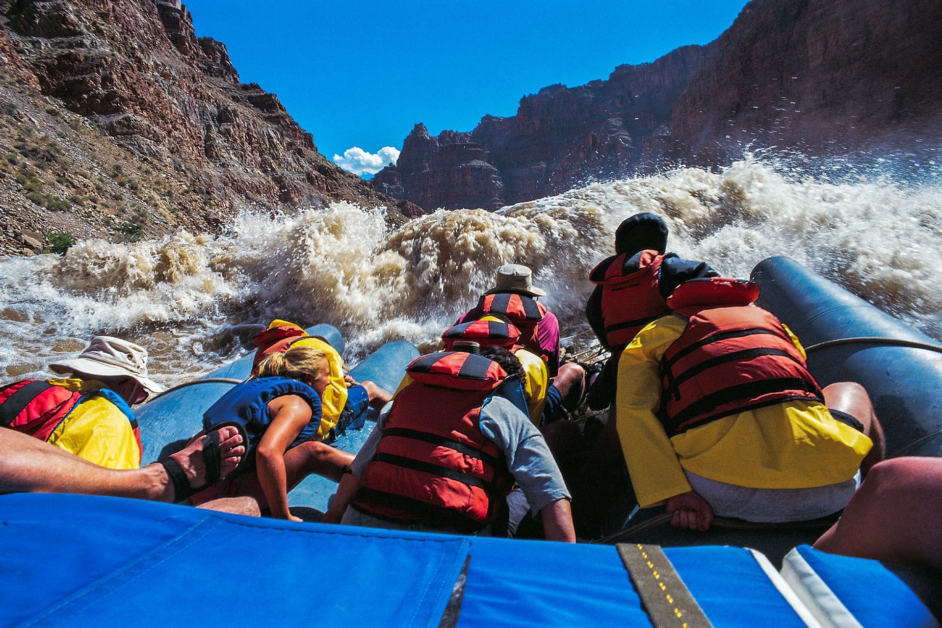
Journey 100 miles through remote red rock canyons with roaring whitewater & star-filled nights on this all-inclusive expedition from Moab to Lake Powell.
- Duration: 4 Days
- Departures: Weekly
- Season: Jun -Aug
ADULTS 16+
$2,050
YOUTH 10-15
$1,750
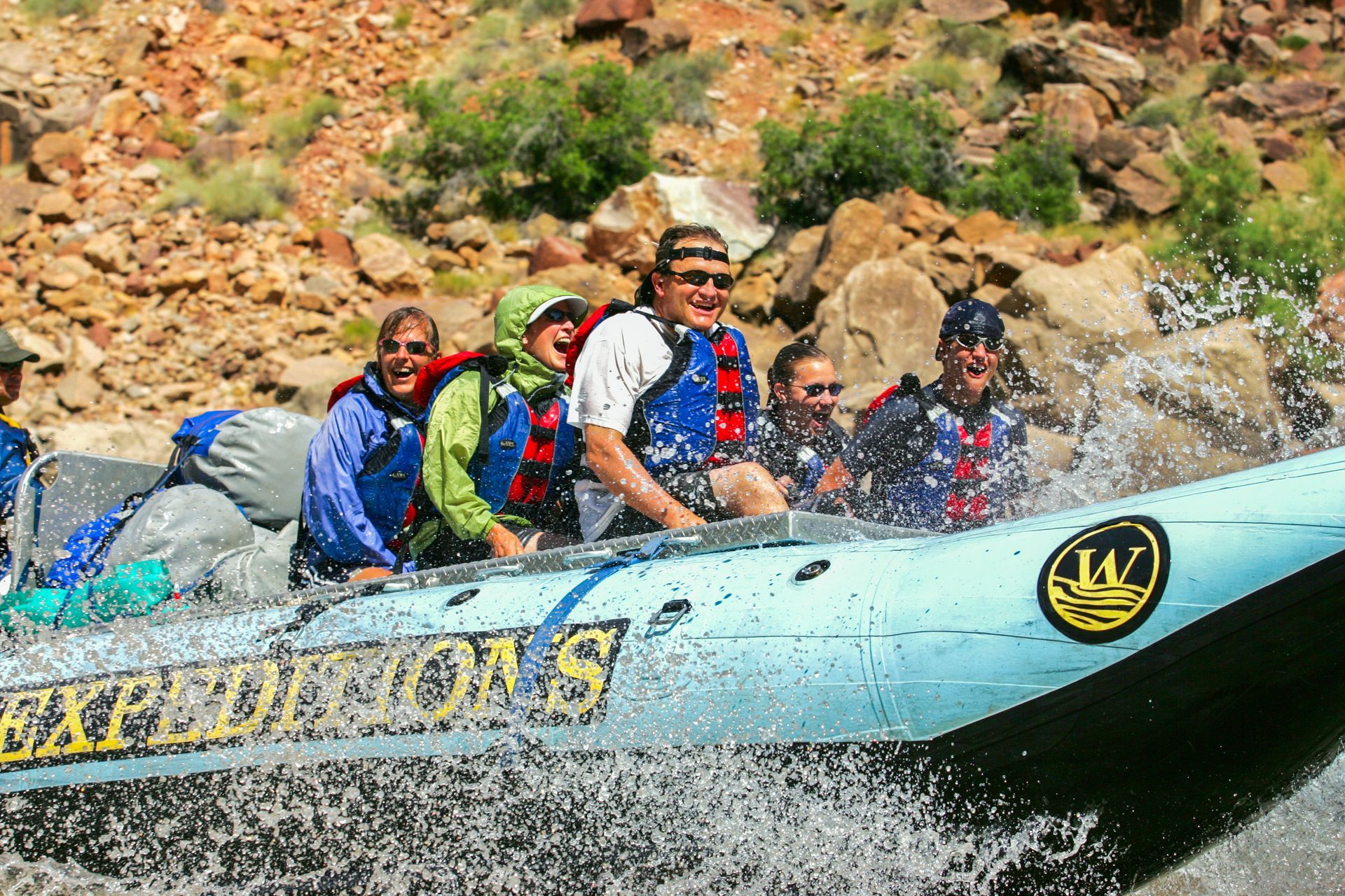
An epic, fast-paced, 2-day journey through Canyonlands National Park with roaring rapids, deep wilderness & star-filled nights on the Colorado River.
- Duration: 2 Days
- Departures: M, W, F
- Season: May - Jul
ADULTS 16+
$1,150
YOUTH 10-15
$1,150
GET THE FREE MOAB INSIDER'S GUIDE!
Join our Moab Insider Email Series
and get our free Moab Insider's Guide
. It's your shortcut to where to stay, can't-miss adventures, recommended restaurants, hidden gems, and how to make the most of Arches & Canyonlands. Real local tips, easy itineraries, and expert advice so you can plan less and experience more
.
BECOME A MOAB INSIDER
With our Moab Insider's Gide and email series, you'll get local tips on the best dishes at restaurants, hidden adventures that most people miss, tips on when to visit, and a few more secrets on the side. Get all the essentials for the perfect Moab experience.
Free. Instant download. Unsubscribe anytime.
⭐️⭐️⭐️⭐️⭐️ 7,000+ 5-Star Reviews | 22-Time Best of State Winner